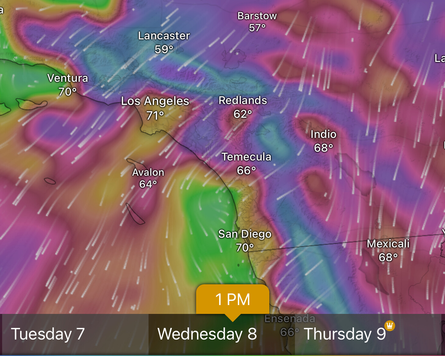
***High Risk days have been added for Tuesday and Wednesday. This is further out than they would
typically be issued, and it is still possible the forecast could change. However, with at least a medium chance of
an extremely high end fire weather event, an early issuance was necessitated. Next week’s forecast should be
monitored very closely
The 12z European model run today is absolutely diabolical. Not only does it have the high-end high wind warning event for the 8th, It brings a second high-end high wind warning event for the 10th. This would be a particularly dangerous situation- considerable, if it verifies.
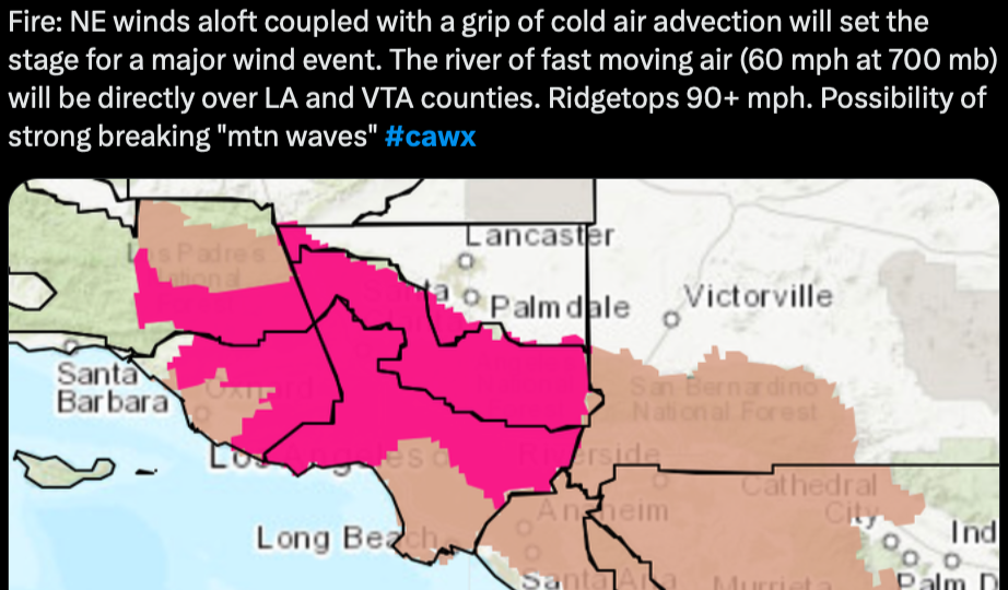
From NWS LA,THIS WILL
LIKELY BE THE MOST DESTRUCTIVE WINDSTORM SEEN SINCE 2011 WINDSTORM THAT DID EXTENSIVE DAMAGE TO PASADENA AND NEARBY FOOTHILLS OF THE SAN GABRIEL VALLEY. ANY COMMUNITIES ALONG HIGHWAY 118 AND 210 CORRIDORS WILL BE AT HIGHEST RISK FOR COMPARABLE WIND DAMAGE.
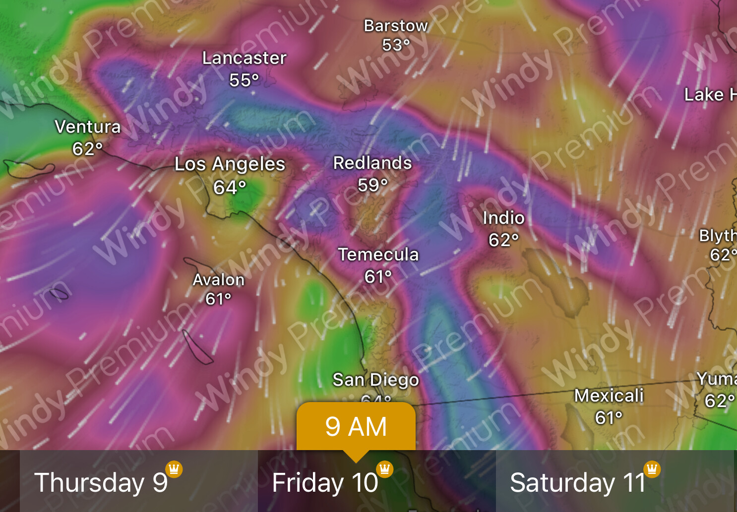
Didn’t want to clutter the incident threads. @anvilhead there was some talk last week that today and then again on Friday may be the strongest models. But the warnings I saw last night said the SA event should die off tonight. Any update from your research? TIA
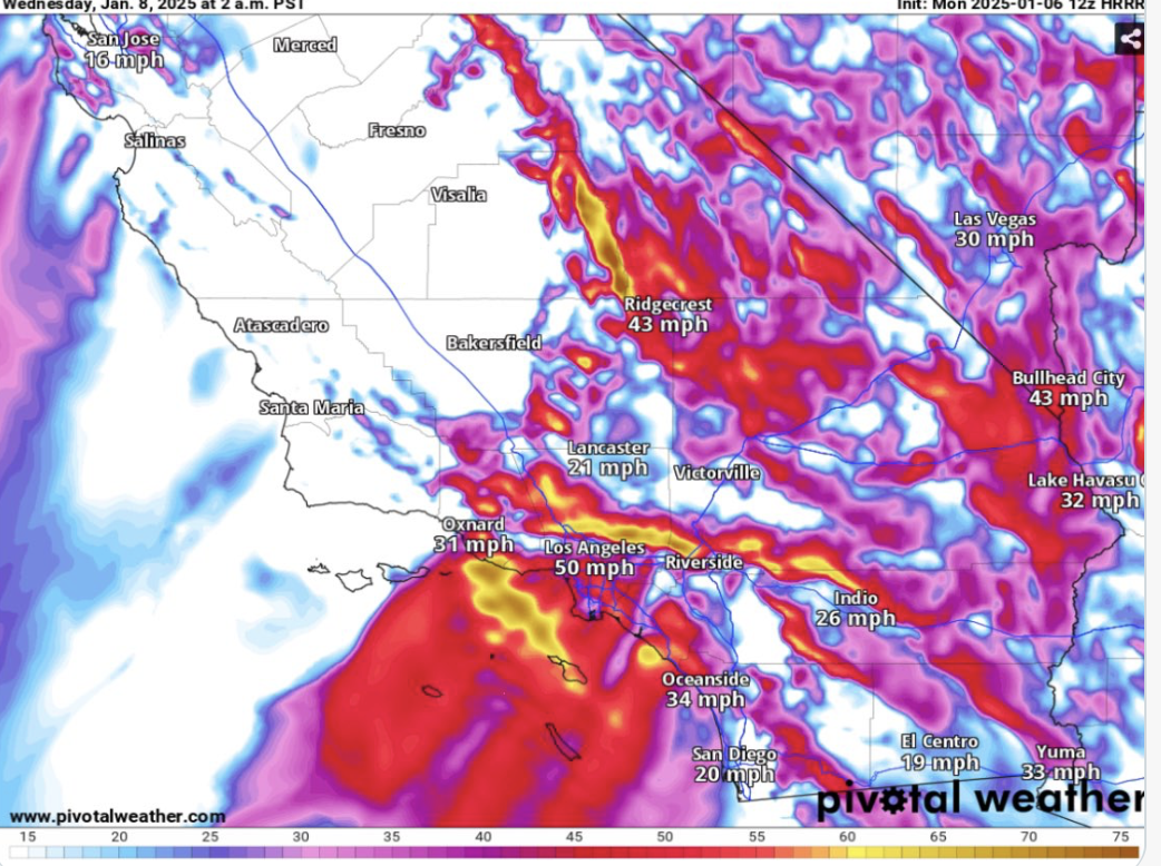
Unfortunately it looks like another Santa Ana is on tap for
Friday. The offshore push from the east will increase to 6 or 7
mbs and the NE upper support will increase. This will be a more
typical Santa Ana with predominantly NE winds focused along the
typical Santa Ana wind corridor from the Santa Clarita Vly to
Point Mugu. Wind advisories are likely in this area from early
morning to early afternoon. The downsloping winds will also reduce
the humidities and increase the fire danger.
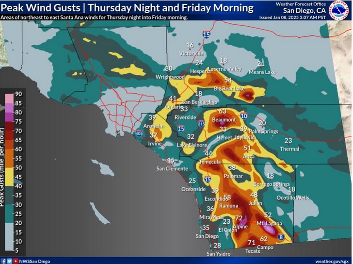
NWS San Diego is saying a 2nd surge of winds Thursday night into Friday more directed at San Diego County this time. Winds gusts in the 70’s still likely in wind prone spots.
I am worried about a classic Santa Ana wind event for Thursday night into Friday. This will favor more of an easterly component such as the inland empire and San Diego county. These areas have not had as low of humidity values due to the proximity of the upper level low and precipitation. Some of the operational models seem to struggle a little bit with the strength, but it looks like an upper moderate event. With the duration of offshore flow, fuel receptivity should be high.
Looking ahead, the 13th looks interesting. Some of these operational model runs, suggests that there could be a long duration moderate to a strong Santa Ana wind event. The upper level support seems to be a lot less for this event right now… But it should be monitored for trending stronger