Well, that’s a safe bet. Like saying it will be cold in Alaska in December.
13 Likes
@Buffalohead like when all these software companies say we predicted when fires will grow large. They say stuff we predicted the fires would grow rapidly on the Eldorado NF in August of 2021. The the Caldor happened! wow quite the prediction, so what your saying is, during a drought, in the hotest month of the year, in the sierra foothills, fires will grow rapidly. Amazing…
5 Likes
I think it’s fair that we give these weather prognosticators their full recognition they desire
as Masters Of The Obvious!
4 Likes
2 Likes
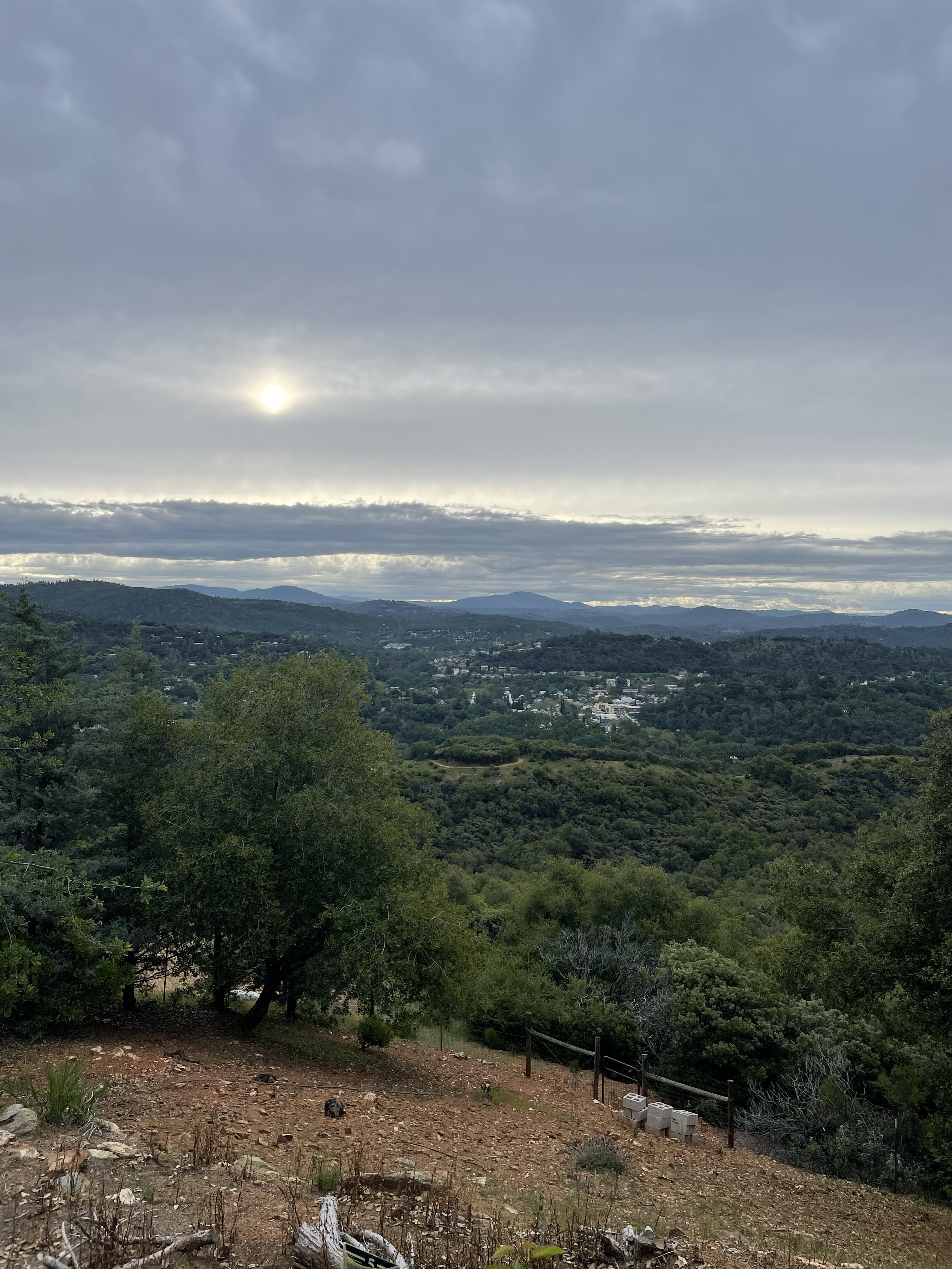
Good Saturday morning to ya. Cloudy this morning looking out over Sonora. 50 out no wind as of yet.
Well, rain is coming anywhere from one to two inches weather folks are saying. Been a couple debris burn escape with the warmer weather nothing to big. Depending on how hard it rains we will see if it lays the grass over. Grass still green pretty green Sonora area and dries as you go down towards the valley.
6 Likes
2 Likes
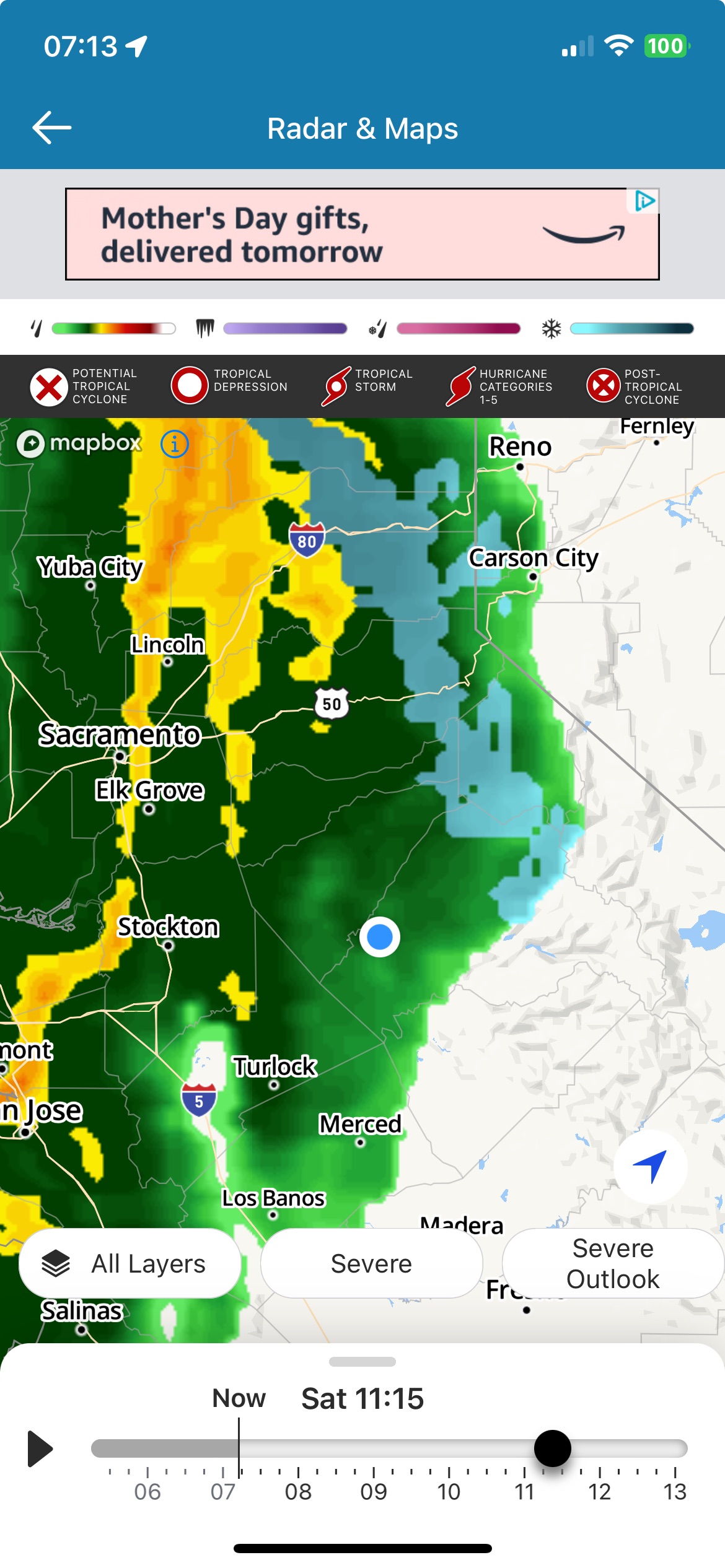
I’m under that little green dot the only rain cloud for miles.
It’s brought some spritzes and even a bit of hail.
5 Likes
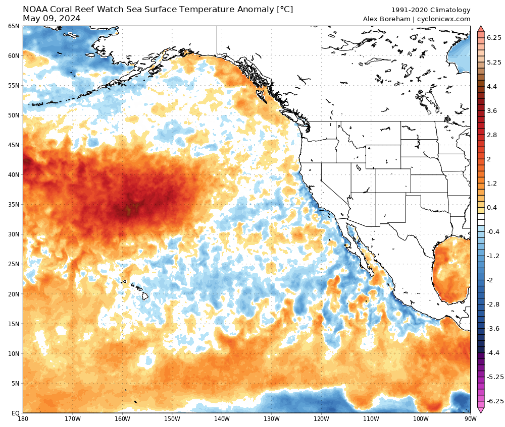
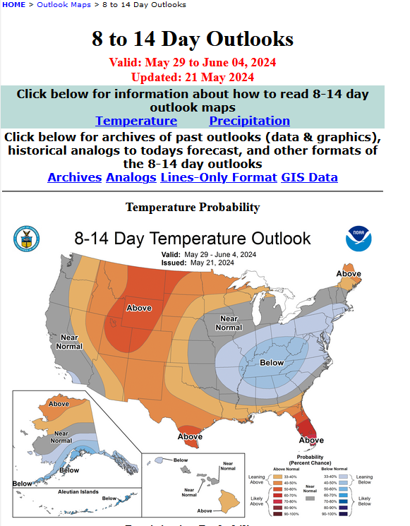
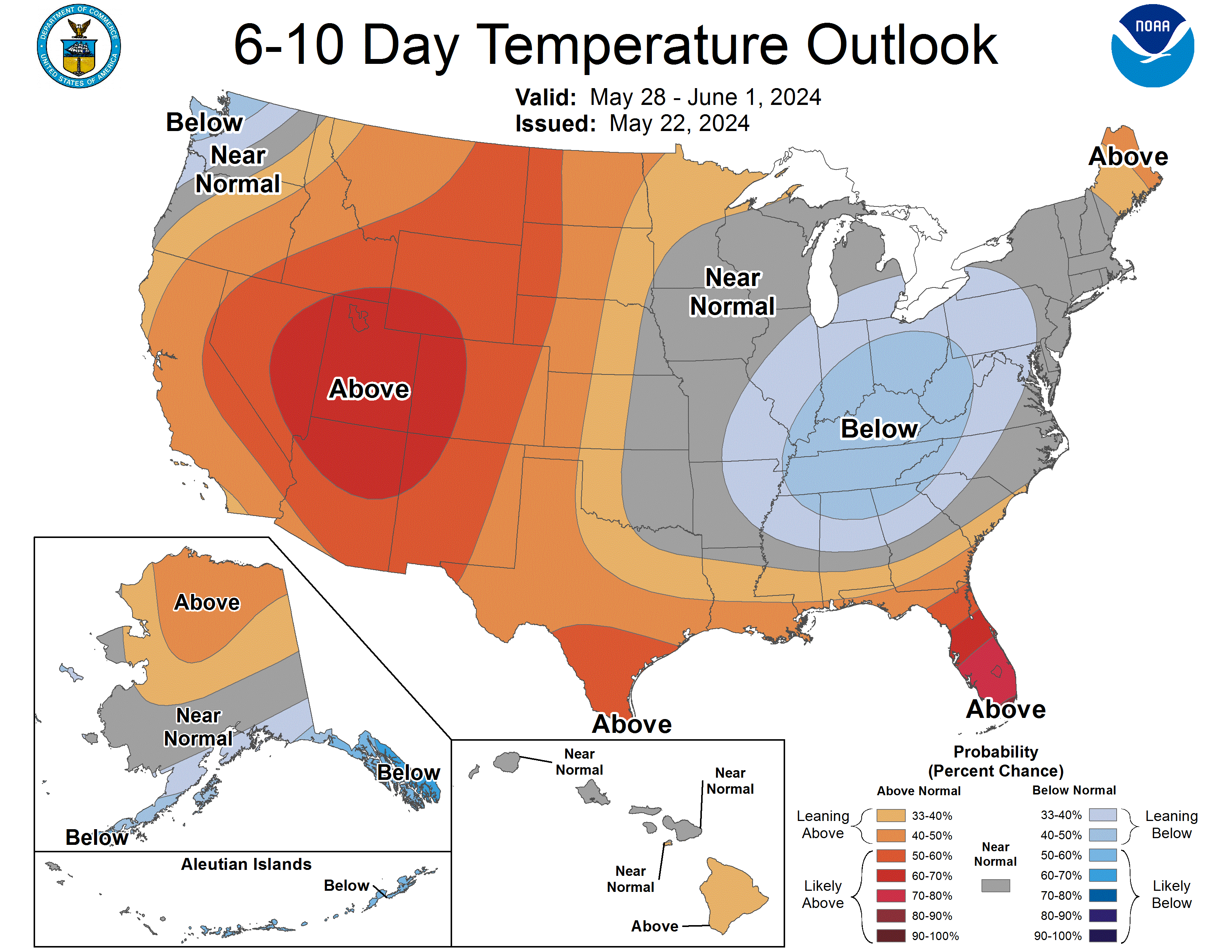
A heat wave is likely towards the end of May and first week of June as a Kelvin wave with water temperatures 5-12 degrees above normal moves in from the Central Pacific.
11 Likes
Good Morning and to you Mom’s Happy Mothers day. It 63,(84 today in Sonora) no dew and the grass is starting to turn. Rain did lay over the grass, some is coming back up some is staying down 50/50.
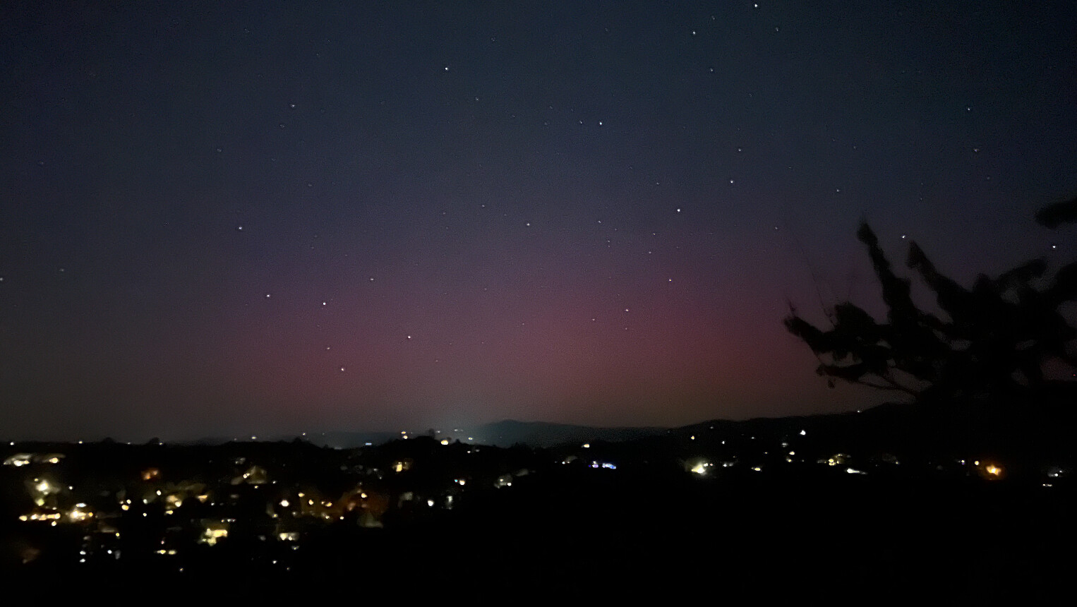
Here’s a pic of the Northern Lights taken just after dark last night.
9 Likes
We’ve got dew down here in Columbia. I was surprised to see that’s this morning.
1 Like
3 Likes
I was just looking at Weather West - California weather and climate perspectives and there wasn’t a mention of this heat wave. Is this looking to be possible/probable?
1 Like
Landfalling kelvin wave in the NW will increase troughing ahead of it and it will be forced downstream into the eastern Great Basin. This will lead to enhanced subsidence behind that trough in early June, in conjunction with the seasonal amplification of the subtropical high pressure system.
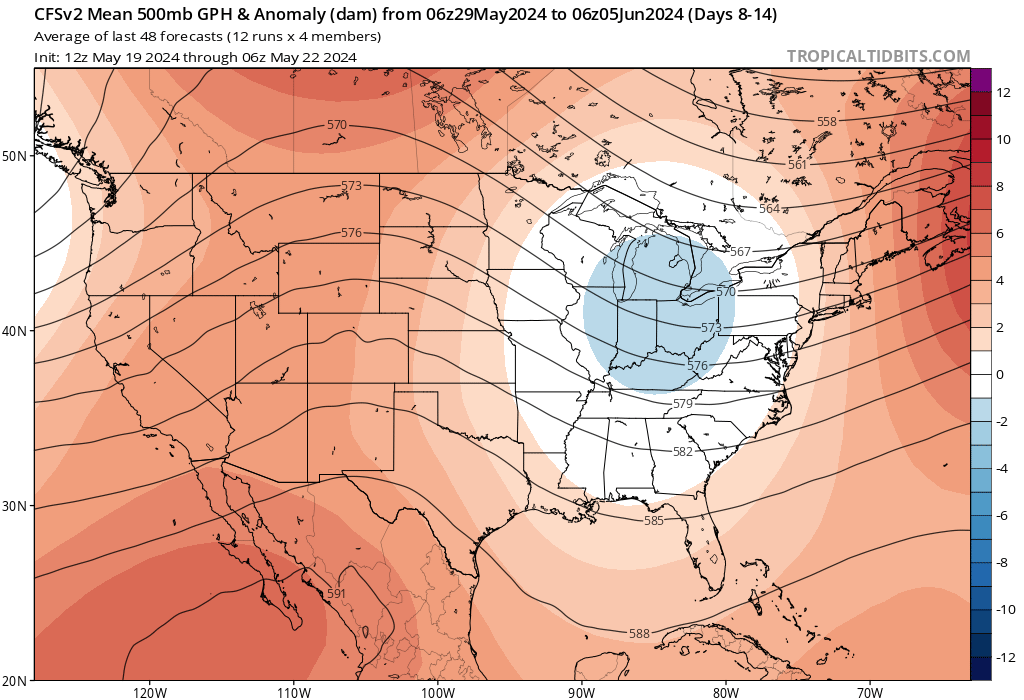
GFS shows it with run to run consistency but not going to use it until under 300 hours.
10 Likes
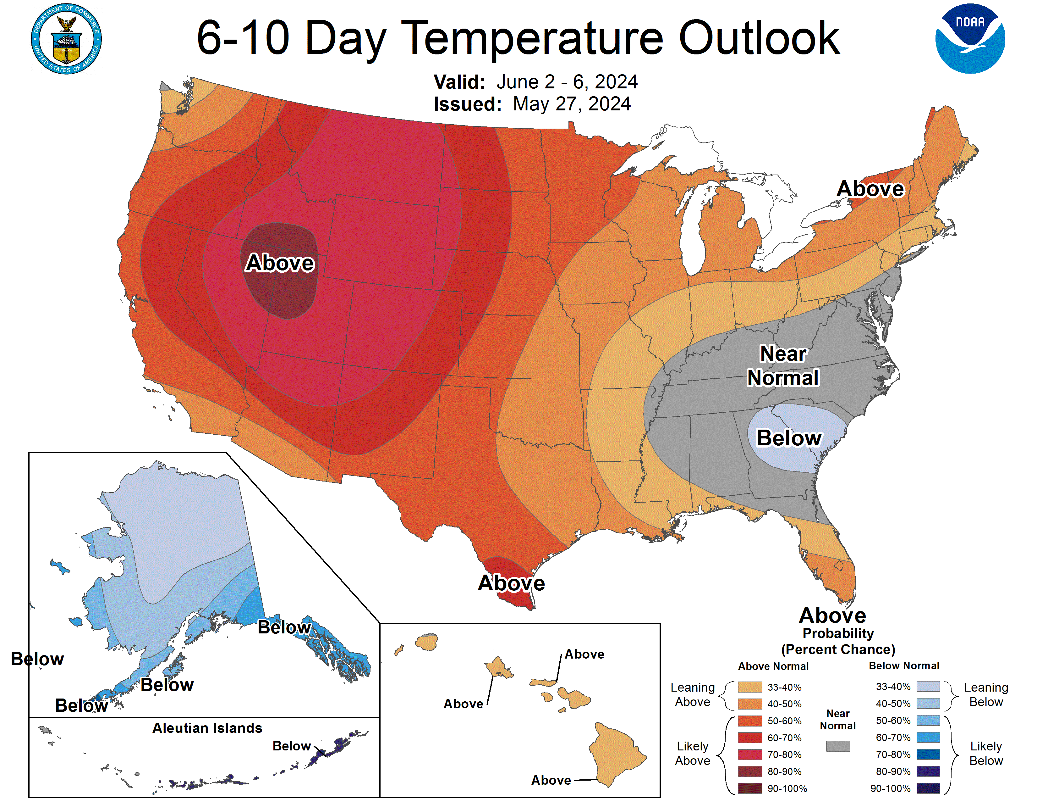
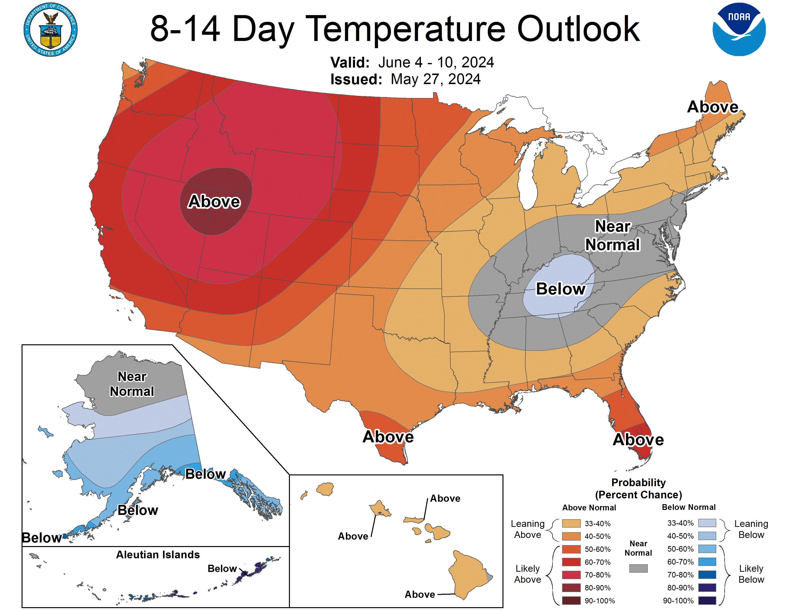
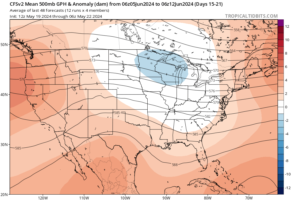
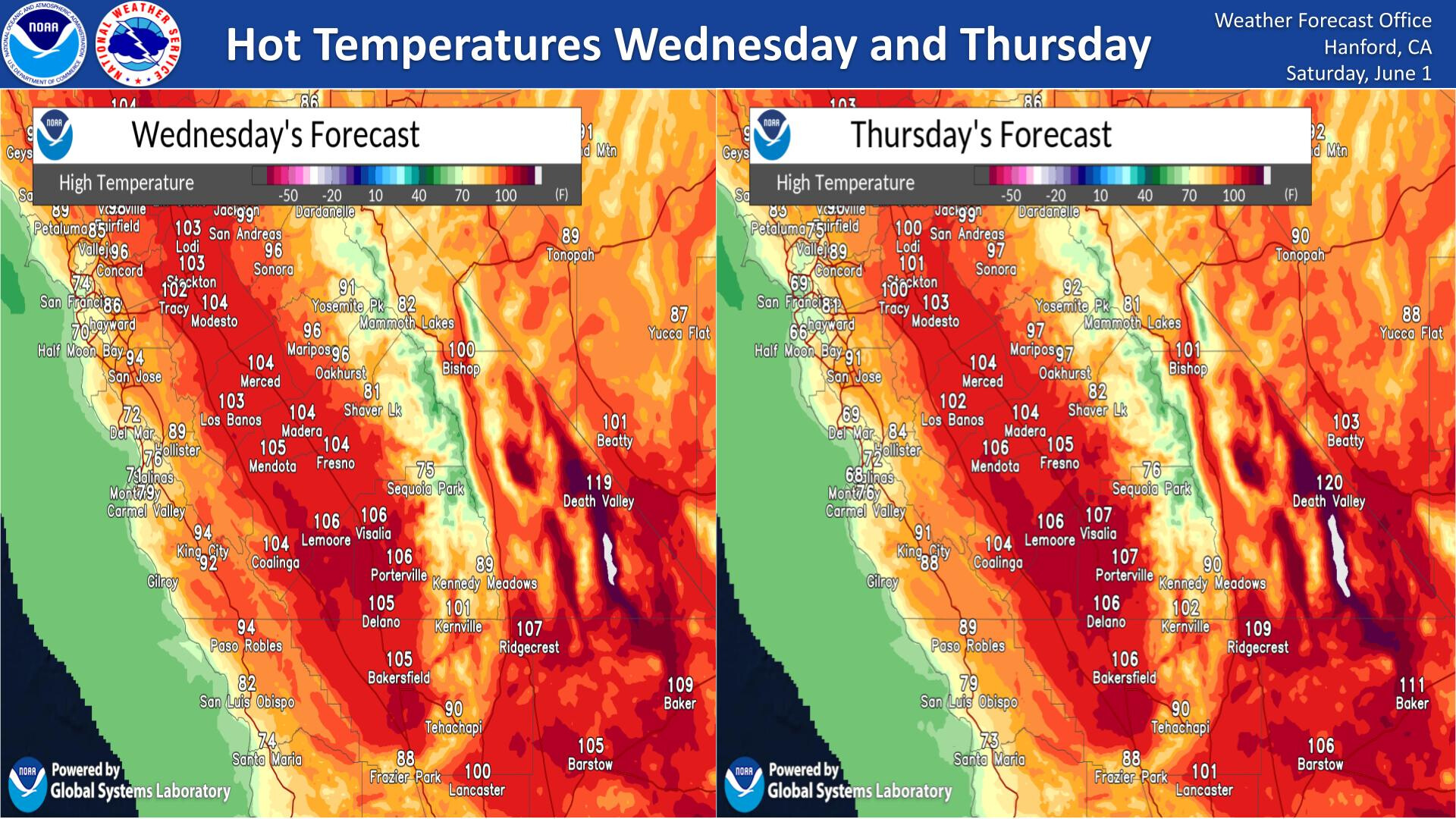
This should kick off fire season in heavier fuels below 5000’. The GFS develops a Rex Block off of the west coast and this could favor much above temperatures the rest of June if it stays in place, as the ridge goes through its amplification cycles. Subsidence from the kelvin blob in the North Pacific and subsidence over Mexico from a developing La Nina means less moisture over the desert SW this monsoon season.

It is better to look at the seasons as becoming compressed into more amplified (energetic) episodes with less individual events. This is due to the nature of the heat transfer process from the ocean to the poles, geomagnetism, and some human activity.
14 Likes
Predicted that one on the nose
6 Likes
Spot on assessment!
With the new build-up of heat in the north pacific Basin, what does the rest of the summer season look like?
Will that heat get below Pt Conception and the SoCal Bight?
2 Likes
In the northern latitudes warmer than average SST can be a sign of subsidence in the atmosphere, ala high pressure. Ahead of the warm water there is increased troughing which you can see occurring in the Pacific NW, but after it moves far enough south and east there should be enhanced marine heat wave activity. I would expect coastal areas to have much higher than average temperatures starting around the solstice. Subsidence from developing La Nina should mean a suppressed subtropical jet stream with less of a low level moisture component. I think the theme this year could be: marine heatwaves, subsequently enhanced heatwaves inland due to less of a cooling component from the ocean, chaotic monsoon.
Understanding the ‘times’ we are in now there is most likely going to be a lightning event of epic proportions in August/September across the west into Canada, I do not think any of this can be changed at this point.
21 Likes