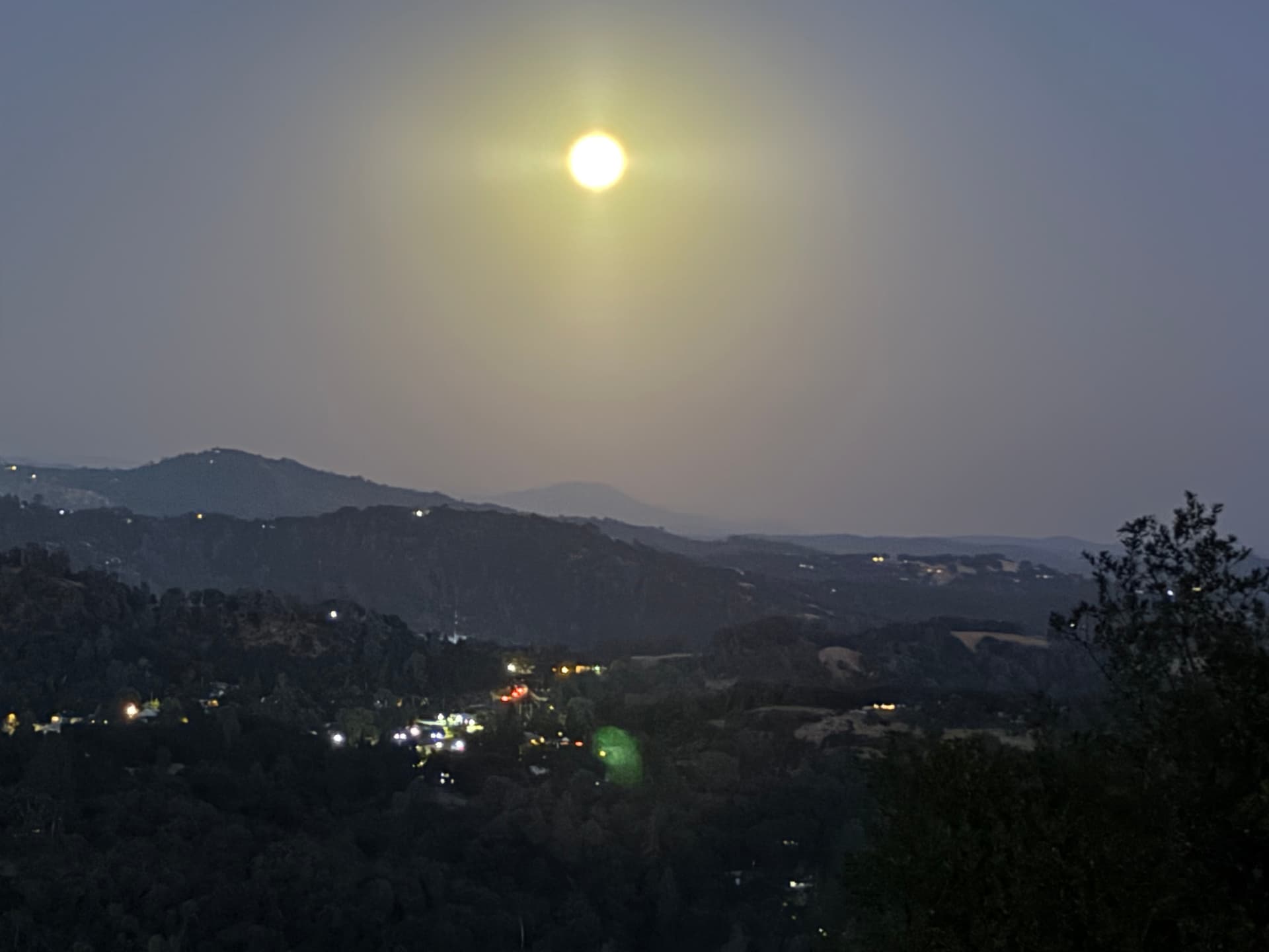
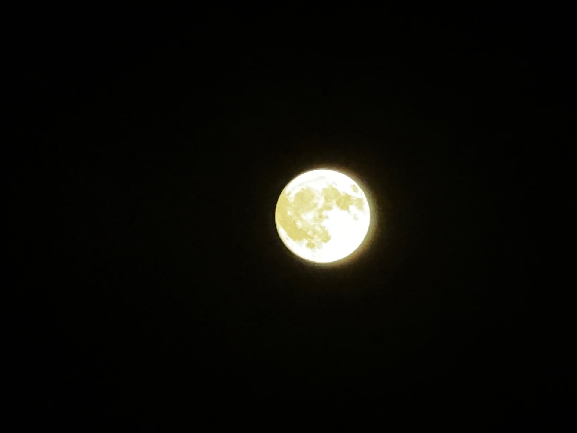
Warmest night of the year here at my house in Sonora. At 21:15 temp is 84 with RH at 29, winds are calm. Here are a couple pics of the full moon looking out over south Sonora..
14 Likes
Saw it last night as well, as bright as day!
2 Likes
2 Likes
So sick of this effin weather. Marine layer already reached the 15 in Escondido in freaking August. Coolest and cloudiest summer in my 54 years here in SD county. Woke up again this morning to fog and dampness. Where did summer go. Actually we never had it here. Another launch from Vandenberg we will miss tonight due to ELA the marine layer. Feels like living in Seattle.
6 Likes
103 in Mariposa today
7 Likes
64 and socked in marine layer in San Marcos. 95% RH
3 Likes
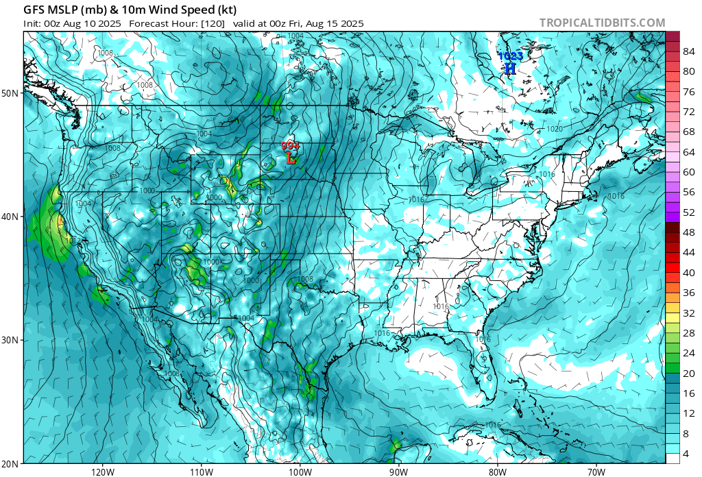
Spending sometime in SOPS this week and enjoying the desert heat.. Looking ahead.. ridge remains intact through Thursday. It looks to me like normal thermal trough development from the heat through Wednesday. On Thursday the ridge breaks down and another trough pattern looks to become established( at least short term). Looking at the models.. wondering if there is a chance for some limited convection? As the high breaks down and the thermal trough slides south a weak wave appears to form and pass over central and SoCal. If moisture left over from thunderstorm development in Baja and the SW moves close enough could it be advected into SOPS.. especially far south Ca? Right now only a few models show that and the convective parameters look meager… but not zero?
5 Likes

They scrubbed the launch — shootin’ for Monday
4 Likes
One other item to watch.. as the high breaks down on Thursday/Friday.. the potential for increased winds along the central coast. Could be a 4 mb pressure differential with strong winds along the coastal corridor and gaps.
9 Likes
No marine layer is an additional upcharge. ![]()
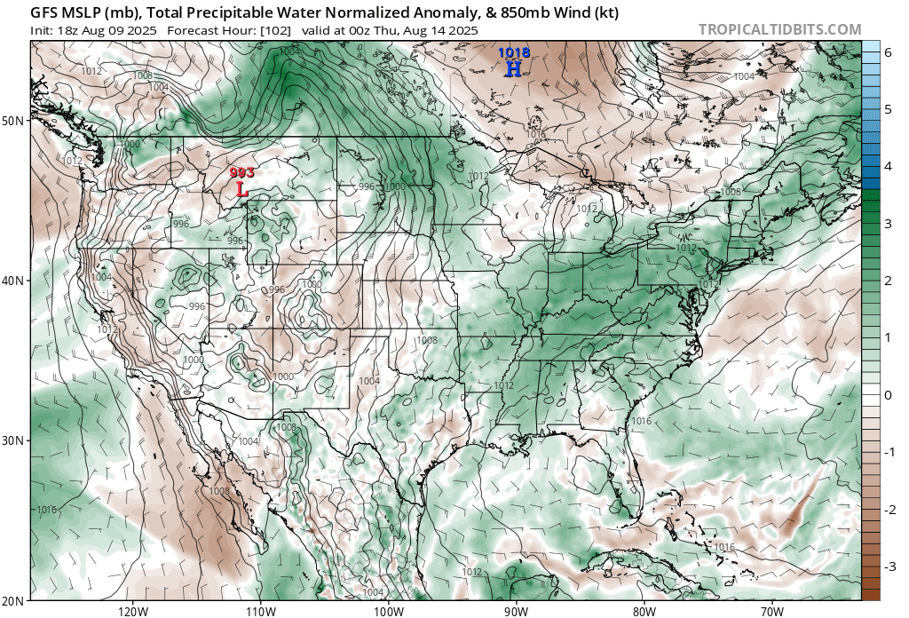
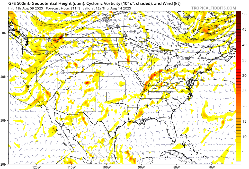
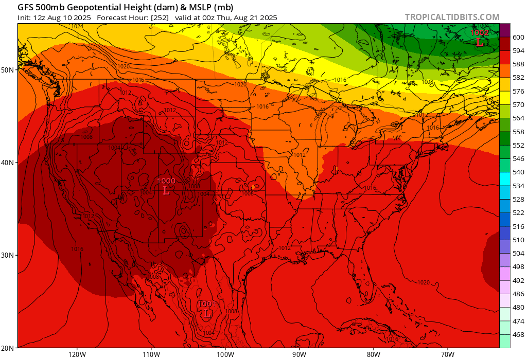
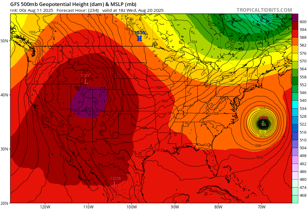
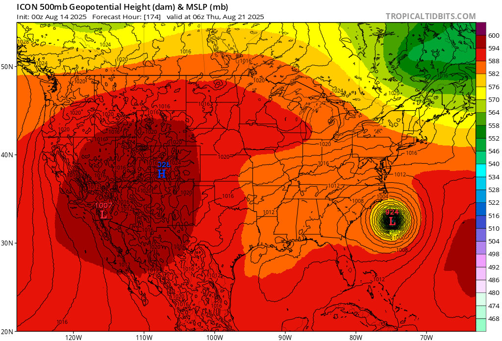
So when the tropical trough amplifies further west over the Atlantic, it should increase subsidence upstream over us. Models are all over the place, but a general consensus is for a strong cyclone to develop off the monsoon trough in the Atlantic (97L and possibly more) making its way over to the Western Atlantic around the 19th


4 Likes
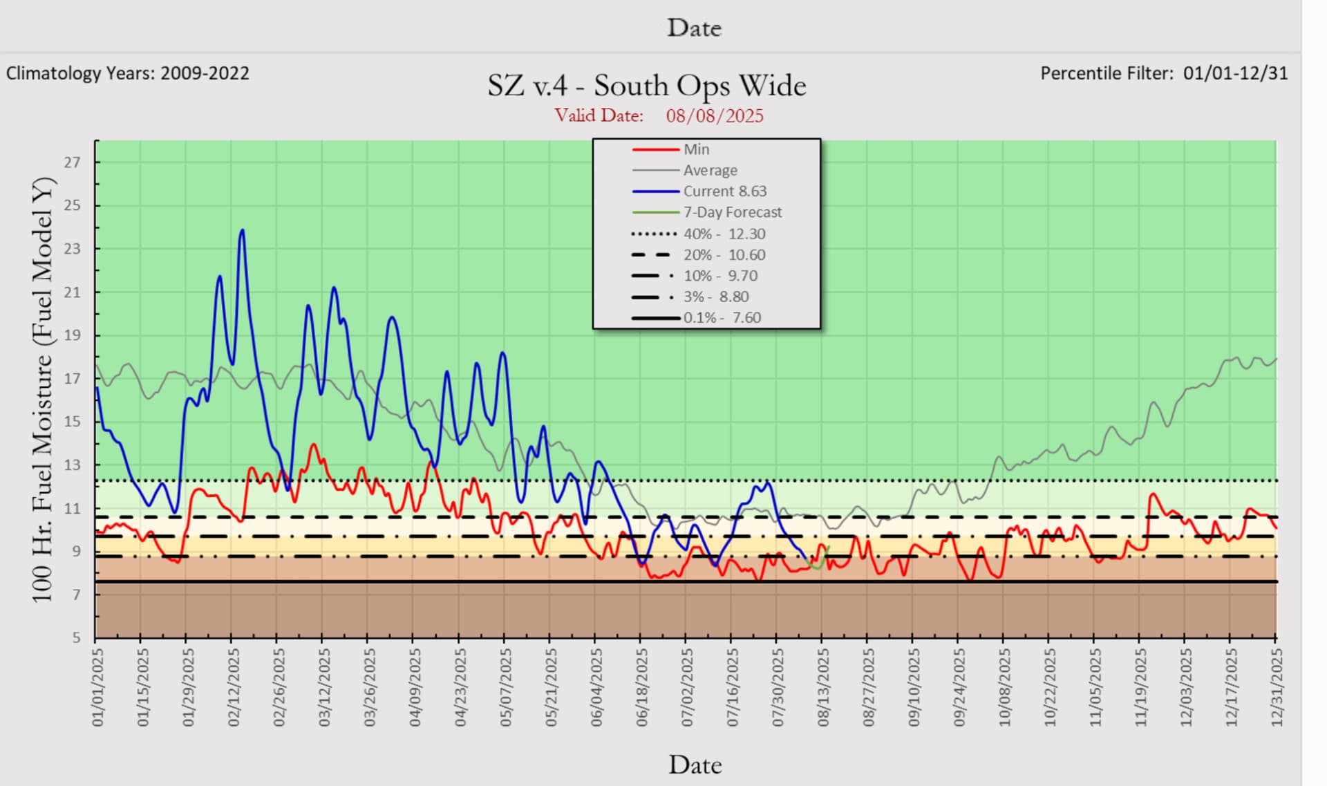
South ops has had no monsoon this year whatsoever and is at record dry conditions area wide for this date.
6 Likes
So is this an indication past the 19th we may be seeing some so-cal precip even if it is very light?
Or will that monsoon trough simply bring slightly cooler temps?
2 Likes
Monsoon trough I referenced is on the Atlantic side. Amplification of the monsoon trough in the Atlantic should lead to subsidence over us and increased temperatures.. not sure if we get a monsoon influence. A little too far out. Models right now vary, depends on how the tropical cyclone sets up in the Atlantic most likely.
GFS is not great 10 days out, but we can use deductive reasoning because all models show the Atlantic waking up.
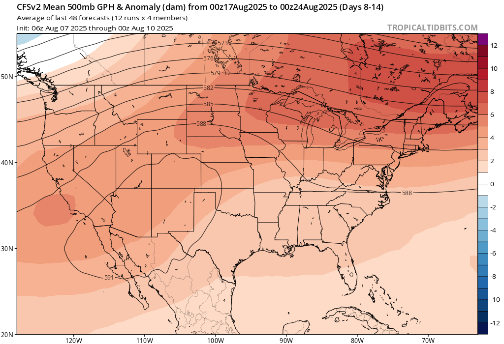
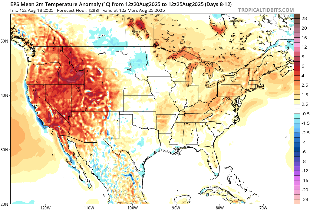
CFS weekly climate models show increased ridging for the west coast over the next couple weeks.
13 Likes
6 Likes
I don’t usually make predictions vs using forecaster language but I will predict “the storm” is not going to miss the east coast and the setup with troughing into the upper midwest at same time will bring us a major major heatwave.
Just some added exoteric logic is that the models rush the northern jet stream/upper level features by about 24-36 hours after 7 days out.
Watch this and will follow up in a few days.
11 Likes
I feel safe making an idiots prediction that if the above scenario unfolds like you think it will - that situation WILL NOT help the already critically dry fuels one bit! ![]()
7 Likes
3 Likes
A fire weather watch has been issued for the foothills and mountains of Ventrua and LA Counties. WWA Summary for Fire Weather Watch Issued by LOX
The NWS compares this event to the burn conditions that were present during the 2009 Station, 2020 Bobcat, and 2024 Bridge fires.
The lowest RH’s are expected Wed. and Thurss., monsoonal thunderstorms are expected from Thurs. to Sat., along with high temperatures in the 100’s from Wed. to Sat.
9 Likes