There is a staging area run by Cal Fire in Beaumont that is holding 30+ water tenders and 15 Cal Fire dozers and numerous pvt dozers. I was told the staging location will be staffed until the off shore winds of next week.
8 Likes
Ah yes. ICA staging area.
4 Likes
Noble Park. Many a fire camp there.
2 Likes
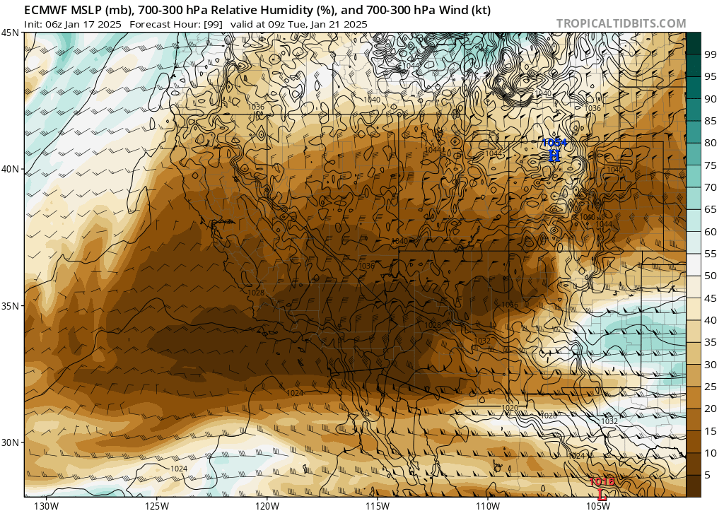
Tonight’s German model run brings another mountain wave event to the LA basin.
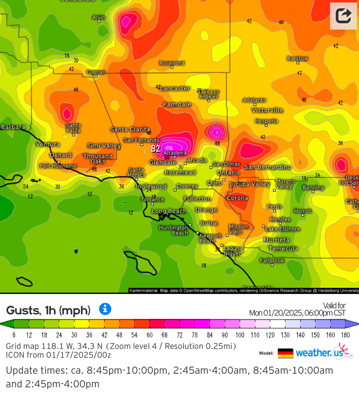
One of the things causing so much spread in the modeling is a satellite low pressure system off of the coast that moves down stream and phases into the larger trough.
Where the cut off low combines with the upper level trough makes all the difference.
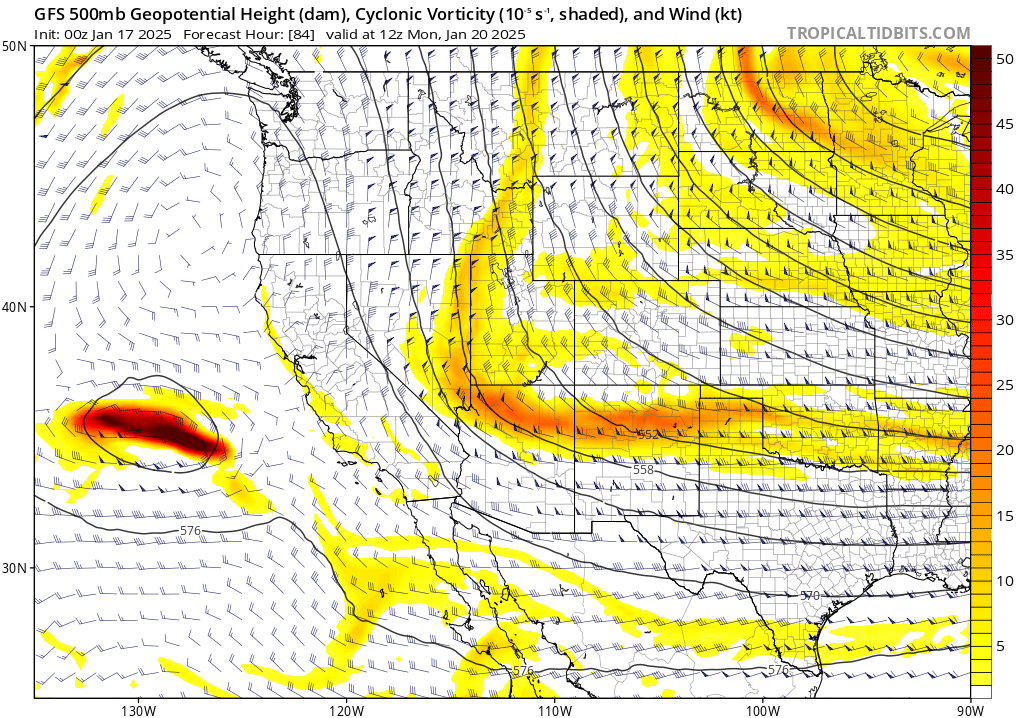
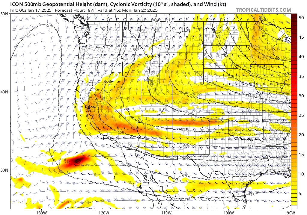
GFS vs ICON upper air positioning
Could make the difference between a destructive wind event and a moderate wind event.
12 Likes
So when is this all forecasted and what does it actually mean?!
4 Likes
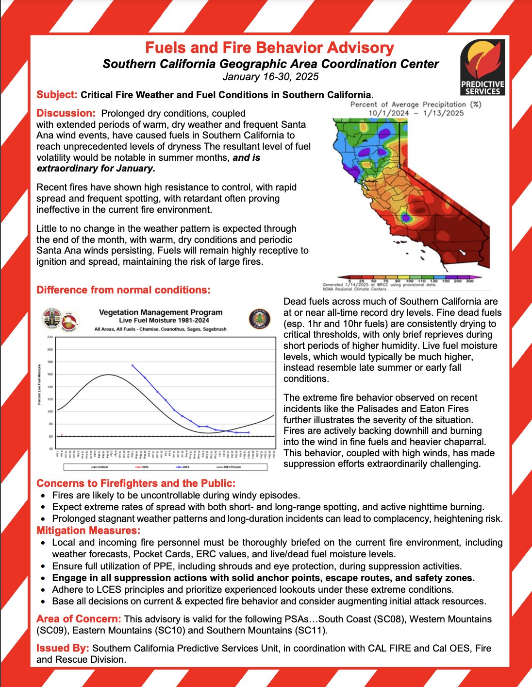
The safest bet is for a moderate long duration offshore wind event, starting about Monday. There is a strong surface high-pressure building into the great basin, but right now is not a lot of upper level support to drive those winds past moderate levels. It looks extremely dry… because temperatures could be in the upper 70s to even low 80s west of the mountains with RH as low as 1-5 %. The big thing is this wind event will likely include much of California, and this will dry out parts of the southern Sierra and could make the area receptive to fire.
There are some suggestions that a very amplified upper level low pressure system may rotate around the larger trough towards the end of next week… That is way too far out, but should be monitored for about the 1/26 time frame.
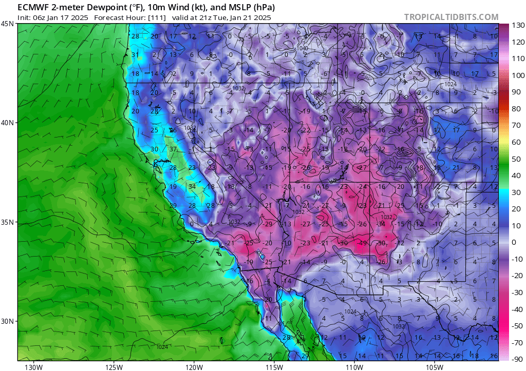
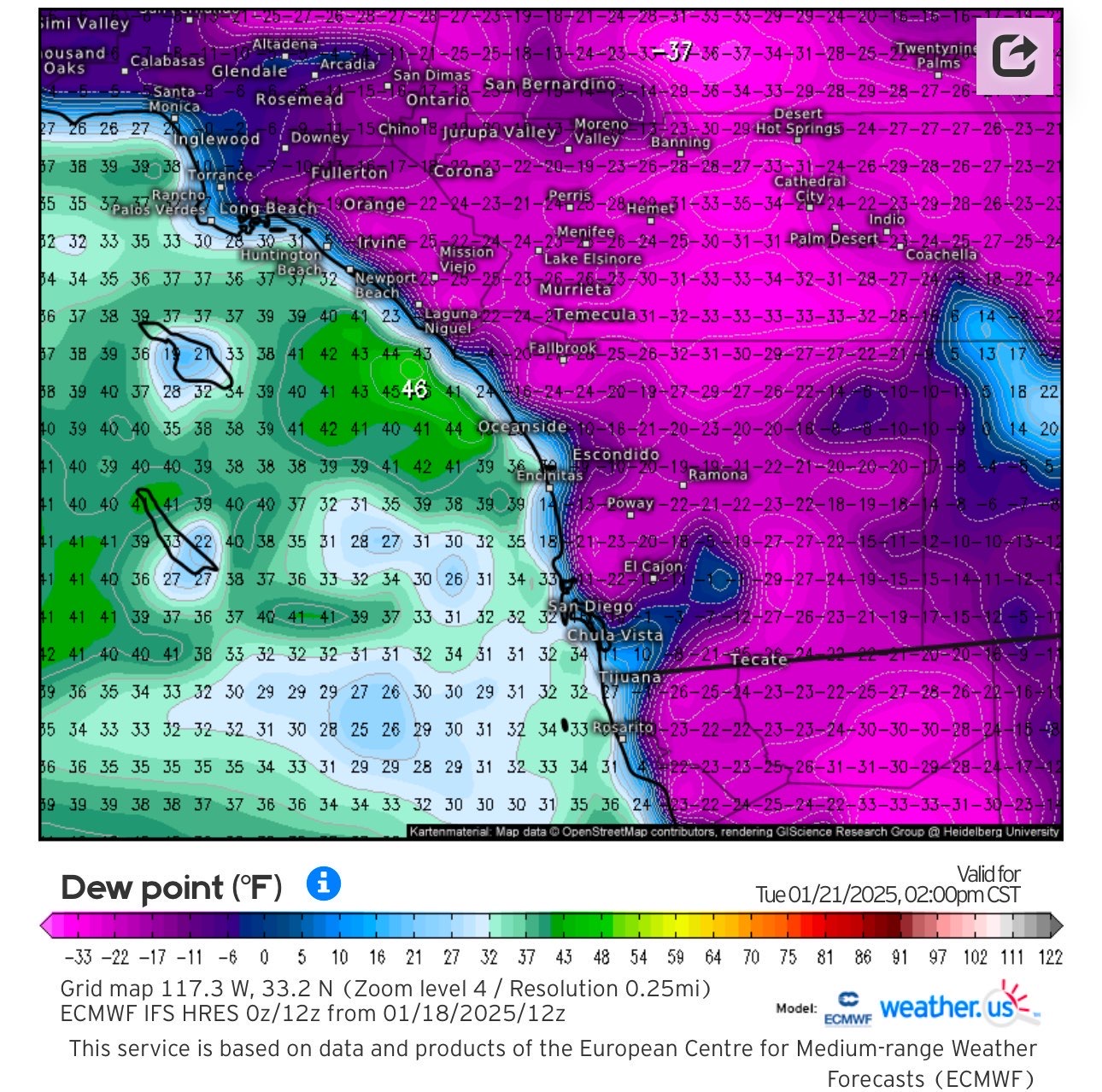
This is the driest airmass I have ever seen over the eastern deserts into Arizona and Southern California. Not an exaggeration or salesman tactic when I say this is shockingly dry.
36 Likes
Trying to find historical data on the lowest dewpoints ever recorded for some of these cities west of the mountains. Even if the European model is exaggerated by 20%, these dewpoints are still incredibly low. There still seems to be really good consensus for the models regarding dew points being low enough to bring humidity values between 0 and 5%. additionally, the trough axis has shifted further west on modeling, which would bring more forced descent in combination with the big pile of cold air slamming into the mountains…. Which means higher wind speeds. The aspect seems to be more out of the east, and would favor the Inland Empire and San Diego County as well.
a great
.
17 Likes
Appreciate all of your updates.
SDG&E must read your forecasts. 
Just received 48 hr PSPS call/text and see that 83K+ so far on the site. We are in Valley Center where the East winds are most worrisome.
PSPS Dashboard | San Diego Gas & Electric
SAWTI shows HIGH for Monday and Tuesday. Should we expect that to worsen or lengthen in duration?
8 Likes
Thank you.
6 Likes
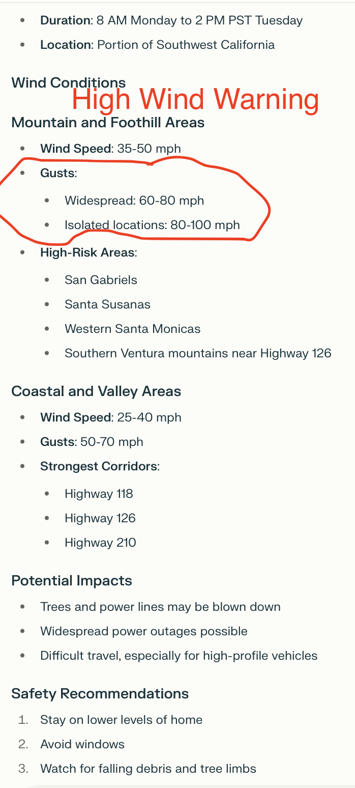
So windy your hands were shaking making that oval. 
22 Likes
Not factoring in the nonexistent humidity and the superty-duperty dry fuels for this event, how does the wind speed/gust prediction alone compare to the early January event (predicted and actual)? Is it lower?
2 Likes
Here are the graphics from LOX and SGX prior to the 7 Jan event. Slightly lower speeds this time from LOX, 10-20mph lower in SGX. I think its important to factor there’s a lower chance for mtn wave activity this time as well. However, I’m concerned about some folks being not as ready when a weak to moderate event is announced. This is not the case here, but don’t forget changes in wind directions when onshore and offshore battle in those events. At this point, any offshore event weak-strong should taken with serious consideration given the state of fuels. Be smart out there folks.
4 Likes
That’s interesting, thank you. Yeah, I don’t think I would feel especially comforted with this event’s slightly lower prediction… kind of like hitting a concrete wall at 130 mph vs 140 mph… bad is bad. This year’s dryness (I like to think of it as extra brut) is scary stuff.
5 Likes
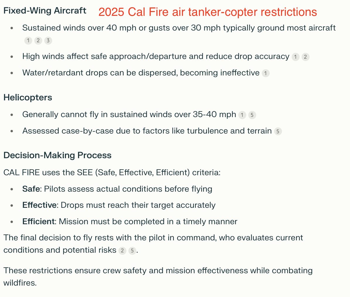

Does anyone else think those numbers got reversed? Sustained over 40 OR gusts over 30? Is it possible to have sustained winds at only 35 (less than 40) and still keep aircraft flying under the second criteria? Don’t sustained winds at 35 pretty much guarantee gusts over 30?
3 Likes
Thought the same
2 Likes
We will see if this event ends up as predicted. Always seems to be slightly less. Looks like it’s targeting mostly IE and no SDU.
5 Likes