Rainfall totals for the last storm were very, very spotty as would be expected in a convective situation. For example, my PWS received .84 for the entire storm despite 1.5” forecasted by NWS San Diego.
Going forward, it will be dependent on where the atmospheric river land falls… The difference of 50 miles could make all the difference between very light warm front rain, and actually getting significant upslope orographic rainfall. After that, this really depends on what happens with the NAO and if it goes negative towards the middle of the month…
A return to NAO negative should lead to more continental air masses, and inside sliders…. Right now, it is in a positive phase.
Also keep in mind that frozen precipitation does not have the same effect as rain because a lot of the snow will sublimate off the mountains… So we need a good atmospheric river to come through to end fire season at this point.
Also without being dramatic… unimaginable meteorological events and meteorological sequences will be occurring going forward.
If most of the models are to be believed a series of AR’s will impact areas north of about Highway 88. Some uncertainty about where the north/south line sets up with regard to the impacts of the AR’s( plural).
Models are spitting out some insane( stupid, incredible, ludicrous) numbers. Too far out to freak out yet… but what is for sure… beginning Friday-Monday a long duration precip event on the warmer side will impact areas north of Highway 50. Could fluctuate 50 miles north or south. Typical spots will be the bullseye… Sonoma/Mendocino Coast, Feather and Sacramento River watersheds. Those areas will see potentially up to double digit totals through the end of next week. For now… count on 4-6 inches over the weekend.
As Anvilhaed stated… some potential for some decent moisture to make it south…
I was also in the 1-1.5" color from the NWS and received only .67" here in San Marcos. What was even more interesting is that our forecast for Monday was 70%…showers likely. Dry all day under mostly sunny skies and not 1 drop from the sky. Think this was kind of a miss from our local office IMO
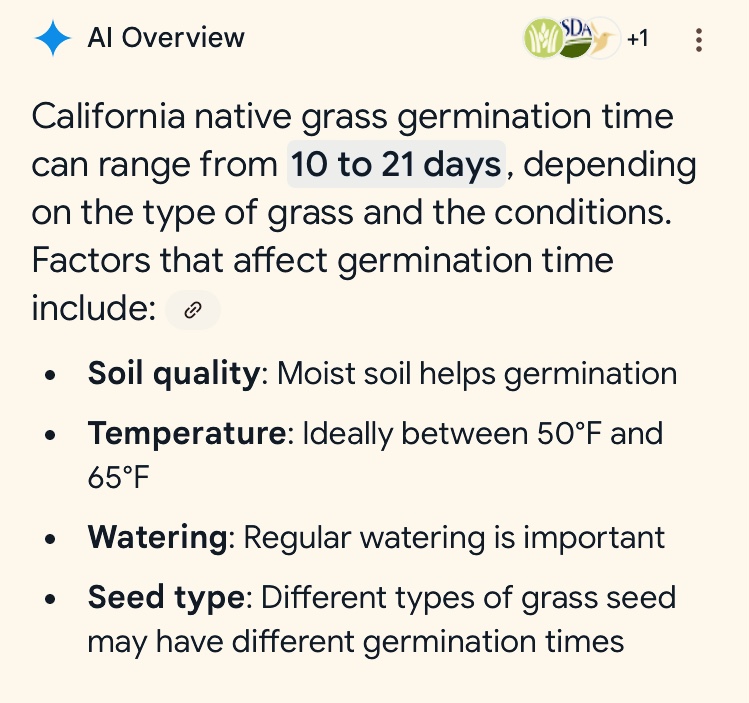
Does someone here know if there a good resource for tracking the rainfall needed for a new grass crop here in SoCal? Or perhaps a table outlining approx rainfall needed to foster a new grass crop that can be referenced? I swear I’d seen one before but may be imagining something.
Not sure of a actual chart, but in S-290
Intermediate Fire Behavior class notes information said most grasses need very little moisture to germinate. Then the 85-90 day growth clock starts, as most fully mature by then
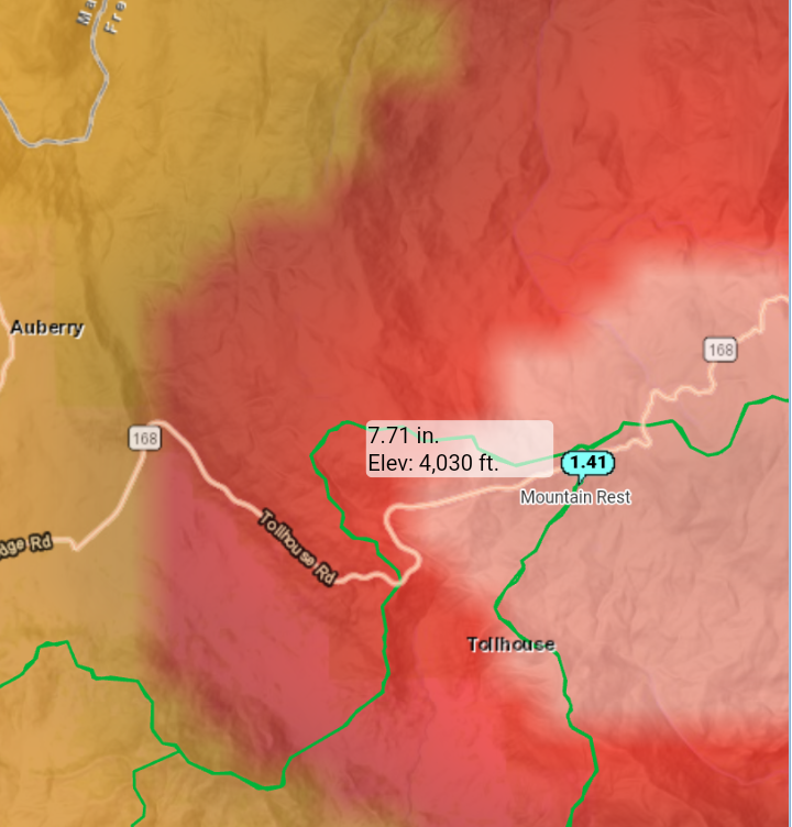
7-10 inches of rain around meadow lakes yesterday, Auberry road got turned into a river but the county has done an excellent job making sure it was ready.