Just some season primer. Increased trade winds across the South and Mexico from ENSO neutral conditions. Strong ridging over the Gulf Of Mexico and Southern US along with a normal jet stream should keep things hot this year across much of the US. The ridging over the ocean and stronger trade winds + no subtropical jet stream enhancement can lead to high SST across the Gulf Of Mexico and off Baja.

According to my research, Tropical storm Alvin is the third highest latitude tropical storm ever in the month of May for the Eastern Pacific and likely to become the second highest latitude by morning.
13 Likes
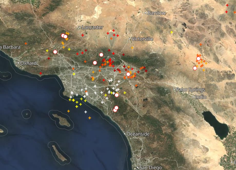
Today into tonight is likely to be up there with one the of the highest lightning totals in Southern California history. Good thing fuels are still not receptive and there is some rain involved.
4 Likes
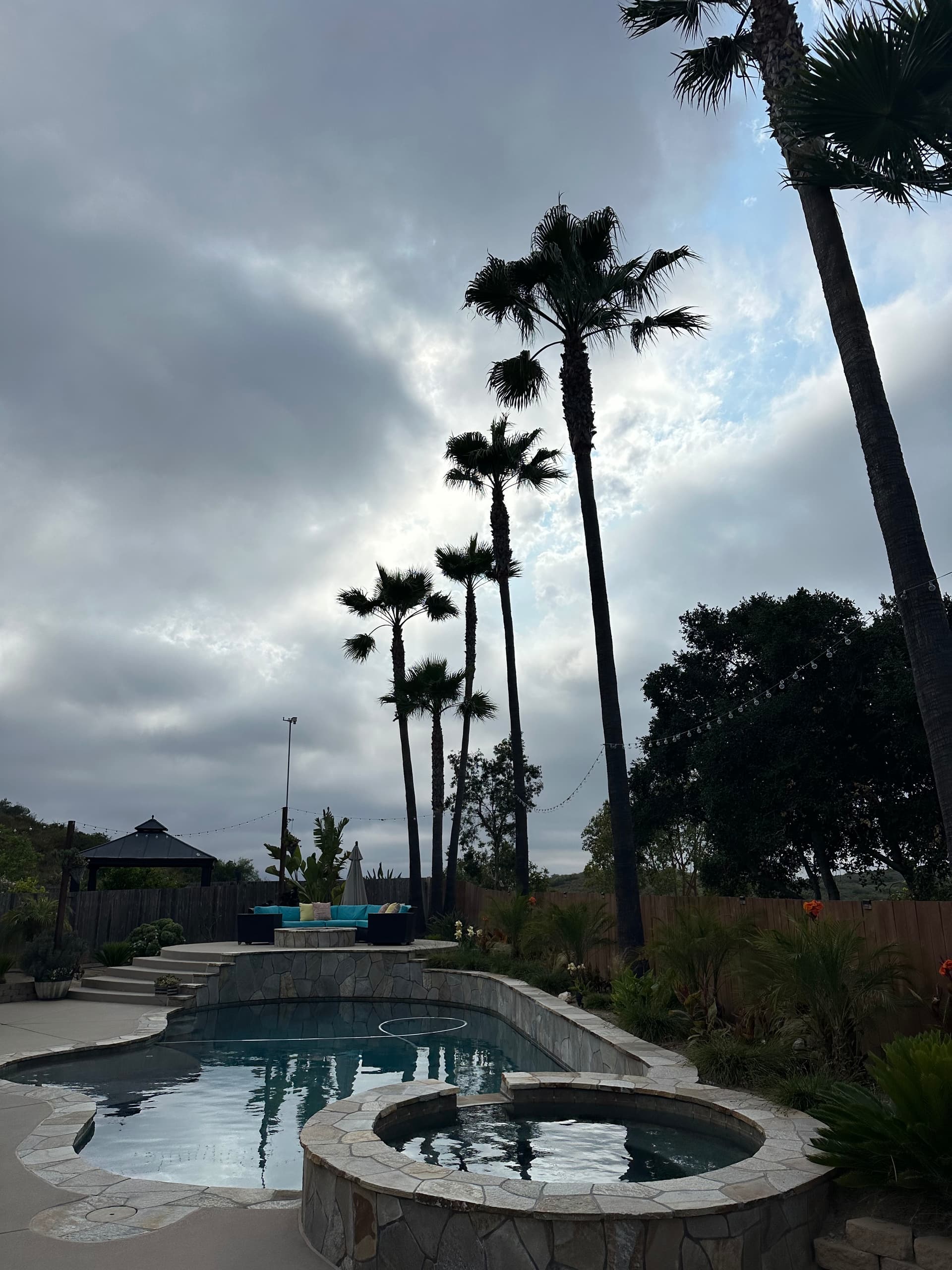
Hard to believe as we are socked in with the marine layer everywhere mostly west of the 15 in SDU.
4 Likes
Mid level instability. The marine layer will probably be disrupted from convection as the rain and outflow interface with it.
9 Likes
Hearing heavy rain and lightning in Fallbrook with several downstrikes reported with power poles on fire . It’s still socked in fog here in San Marcos only 10-12 miles from these cells. Been here all my life since 1971 and never seen June weather like this
7 Likes
Severe geostorm the last 5 days helps charge the ionosphere and global electric circuit, it helps boost the lightning potential. If anyone has final lightning count would be curious to see how many lightning flashes were recorded in total. June is typically zonal flow until the end of the month. With Alvin advecting moisture into the region what would typically be a dryish upper level low was able to produce what we saw the last two days. With the California current weakening every year and SST changing from a various reasons we should expect more chaos going forward…
The California Current Marine Heatwave Tracker - Blobtracker | Integrated Ecosystem Assessment.
10 Likes
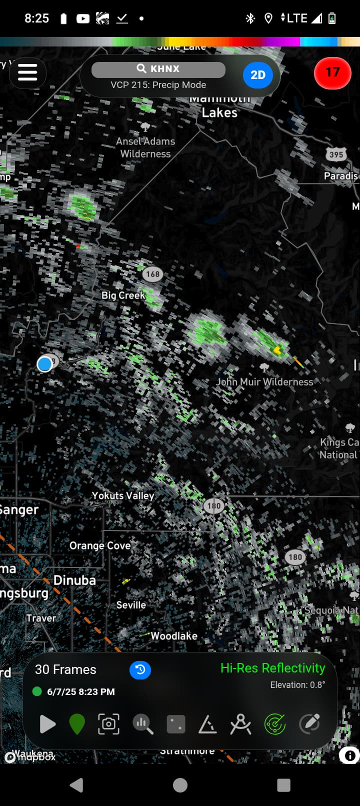
Some tiny storms throwing a little lightning. I’m in that area.
3 Likes
Yes 168 at lodge. Just past Hurley station and it was raining.
2 Likes
Might not be the place, but can anyone expand on what systems are set up for an unusually high wind pattern for the Salinas Valley this year, particularly Salinas to the SLU line is where it happens . 30-40mph almost every day so far. The valley always has winds like this in the summer influenced by the marine layer but it’s abnormally higher this year.
7 Likes
Microclimates are tricky and require a lot of research to verify small scale pattern changes. Often we are accustomed and conditioned to a certain set of standards and anything which changes that pattern of life we really feel.
I will say that there are two things which come to mind without really knowing the area all that well.
The Pacific off of California has seen some cooler than normal sea surface temperatures. With consistent NW winds blowing across that cold water.. we see some changes.Less marine layer but also more temperature differential. That will cause a stronger daily diurnal flow.
A second thought.. we have been in a rather persistent a ridge/trough pattern this Spring. No real huge ridges this year, but rather short warm ups and then a rapid cool down. This “progressive” pattern has caused more wind due to the pressure differentials that exist when ridges and troughs trade places.
That is my best guess…
12 Likes
Right on makes sense. Thanks for the input.
3 Likes
Kickin off Summer weekend officially down to 53* last night in the Central Sierra Foothills, I’ll take it
Cheers
7 Likes
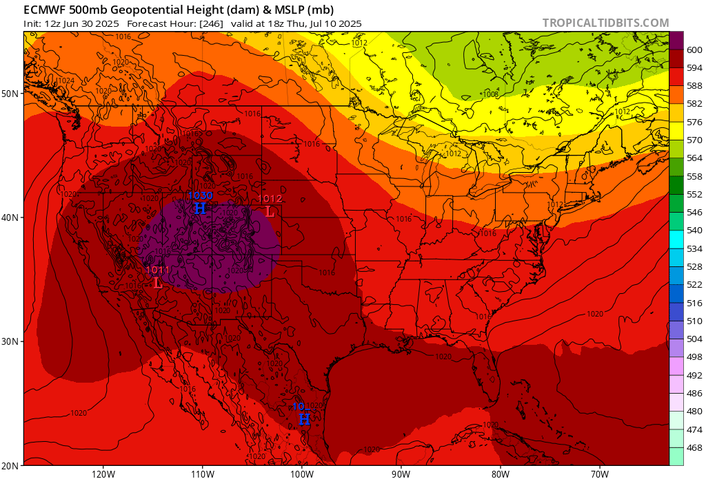
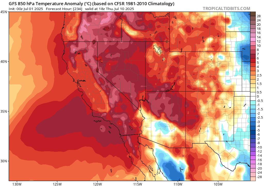
Forecast models are in good agreement for major West coast heatwave starting around July 8th lasting potentially for 3-4 days.
The upper level high pressure system is likely to be located centered near Southeastern California/South Nevada. Subsidence from the high pressure being overhead should keep monsoon tempered during this time despite some moisture possibly being advected from the south.
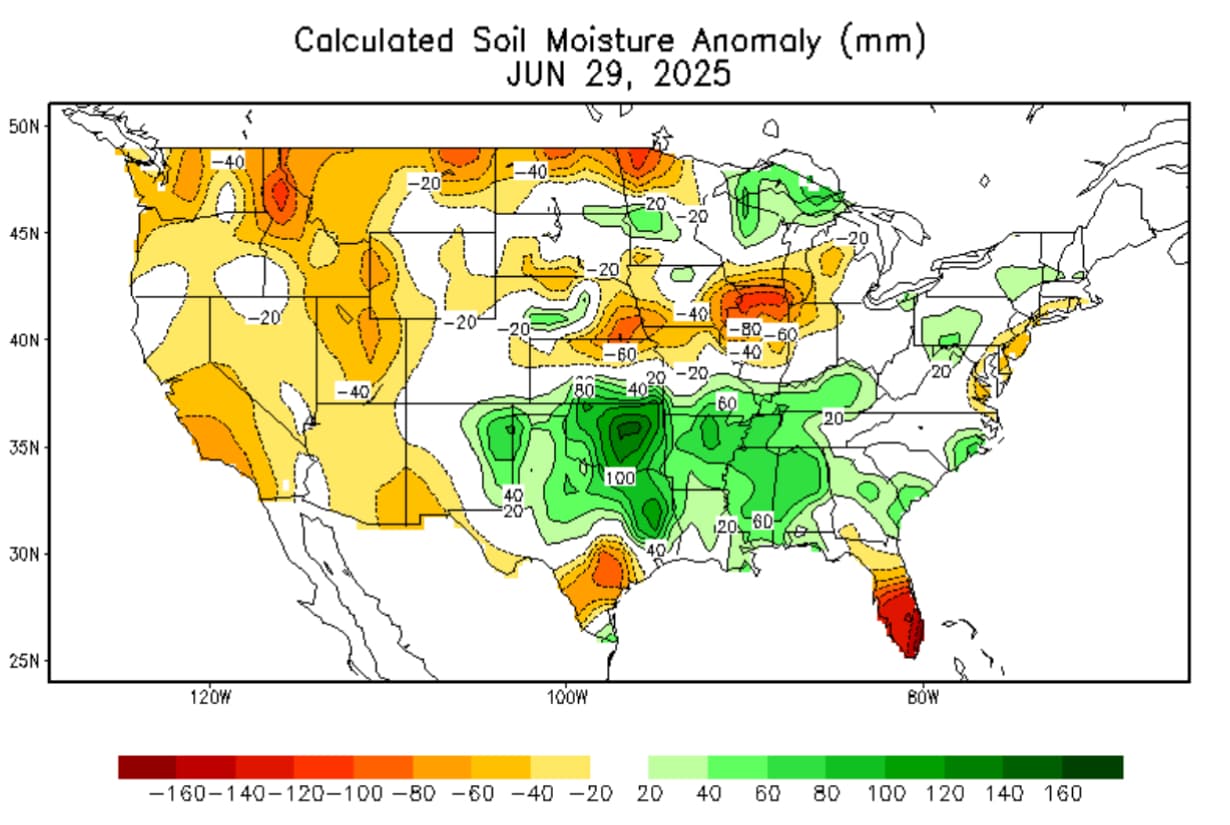
With no monsoonal moisture or recent deep marine layer plus several days of heat leading up to the main heatwave soil moistures are running below normal and thus heavier fuels will likely become stressed/cure/support above normal ERC’s.
20 Likes