The risks of model riding.. today’s solutions are different but equally interesting… this year will be a huge education in the effects of our warm pool of water in the Pacific..
Admittedly I watch NOPS weather more closely, but this does look like a potential
Sundowner event
might occur. Having been there for a few they are certainly a unique phenomenon.
I think it is literally divine intervention that we have not had an extended attack fire with the amount of extreme heat. But then again the inversion is solidly in place and the alligators have migrated to California with the level of humidity.
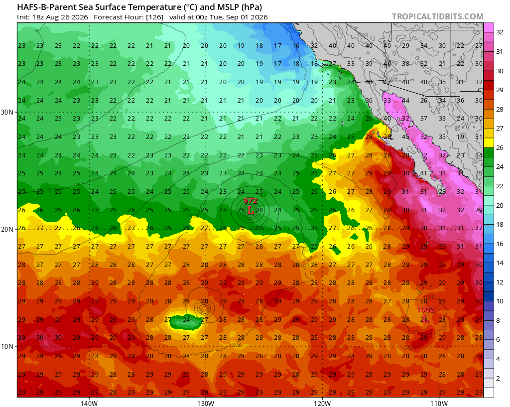
Watching future hurricane Karina develop and it will cause another round of long period southerly swell that pushes warm water up against the coastline. We are likely to see in the next few frames on the hurricane models show the 26° isotherm make it all the way up to Ensenada or just to the south. The more the water gets pushed up to the north, the more it downwells into the thermocline… and thus a storm that develops potentially behind Karina could make it here as a strong tropical storm or even a hurricane.
Brief but intense lightning show around point conception this morning. Witnessed a few cloud to ground strikes between Buellton and Santa Maria. Made for a nice commute.
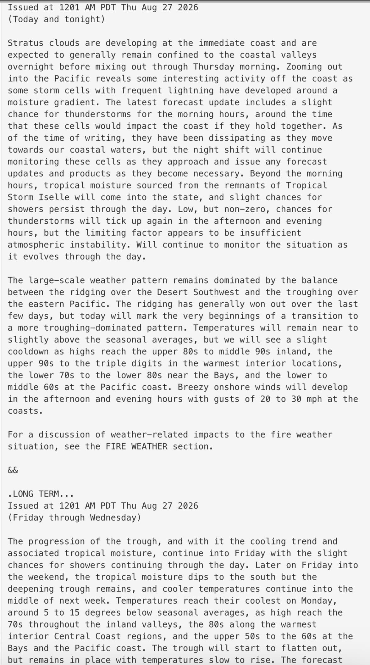
I’m looking at the satellite loop, it looks like this may be coming from one of the tropical depressions off the coast. Does anyone have any information how this will play out today?
South Ops just posted High Risk Days for Central Coast Interior, Central Coast and Western Mountains for today. Sierra Foothills and Central Valleys tomorrow, all for lightning.
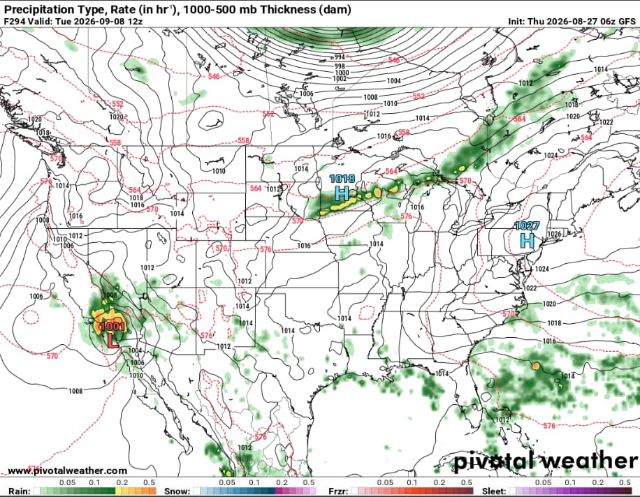
Also at some point you would think GFS gets it right and we get tropical cyclonic activity up baja and into southern California. I’m not holding my breath but feel so teased by it the last month.
For those not aware, GFS is BAD this far out and should not be trusted or have any faith placed in its output for things like hurricanes. It’s low resolution, misses many of the finer details, and has a convective feedback issue on top of it.
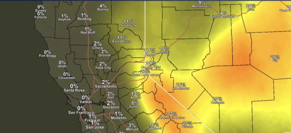
You kind off have to take that with a grain of salt. NWS Sacromento has a good depiction of where and what chance thunderstorms could be possibly happening. Its looking the highest chance of thunderstorms will be in the eastern sierra and possibly foothills south of sacromento, but a very low chance of anything in the coastal range. However NWS Bay Area in their forcast discussion does mention a few possible morning thunderstorms passing in the coastal areas.
I think it has the right general philosophy, but it is wanting to reach equilibrium too fast. Since the monsoon trough is at its peak right now, and it is essentially to our southwest due to how the ridging has been this year….. the axis of the monsoon trough should shift more towards us or the desert southwest as we see every single year now with a tropical cyclone, spearheading it. So as the upper level heights decrease over the eastern pacific all of that stored energy in the ocean will rise and it has to go somewhere. Whether or not it ends up here or further east into Arizona remains to be seen.