OK, so to simplify this a little bit, the sea surface temperatures are much warmer than average, and spreading further north every day as we are at the climatological peak of the monsoon trough… which will push warm water further north. In addition to that the top layer of the ocean is much warmer than average, so if a storm moves over the cooler water off our shores it is less likely to rapidly weaken due to the water it will be upwelling being warmer than average. So if you have a more resilient storm, you could have a closed circulation make it further north rather than being ripped apart by a trough…. And in the 1% chance the storm is a Hilary type or stronger, it could stay attached to the upper level ridge which would keep the moisture confined to its circulation for the most part rather than a mass deluge out ahead of it… and in turn that would set up fire weather concerns. But I don’t want to speculate, so for now we just continue to watch the tropics.
I saw the trough on the GFS way out in on the LR… still a lot of timing to line up. It seems like it could have two potential outcomes… October 2009 style precip event for CNR or August 2003 event with copious lightning. A lot of potential dynamic outcomes.. or it stays on track.. does not phase with the low or HP remains strong enough that all we get are a few cool sunsets. Will be interesting to watch.
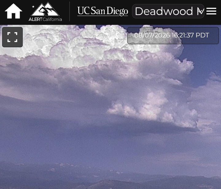
Looks like the wave is likely not to develop now… but it’s going to keep pushing warm water further north. Will be interesting to see when the MJO comes back around later in the month.
For all of us S-190 graduates, is there a reference document that spells out all of the acronyms used in these discussions? Much like wildland fire had to produce many years ago. https://www.nifc.gov/sites/default/files/NICC/3-Logistics/Reference%20Documents/Mob%20Guide/Appendix.pdf
Just wondering. It would really help me follow your informative and I think important information sharing.
Sorry… MJO is Madden-Julian-Oscillation.
MJO is an equatorial traveling band of storms that moves across the globe every 30-60 days, when it moves into the equatorial region below the east pacific it enhances tropical cyclone activity. The correlation is 4x the amount of storms and energetic conversion.
From this am it looks like the TD will just stall out.. without the wave from the north and more of a flat ridge.. maybe more of a hybrid storm scenario?
Yeah, that’s what I was thinking, we might get a lightning bust from the mid level moisture if the ridge is tall enough for Northern California but probably more than likely aimed at Oregon.
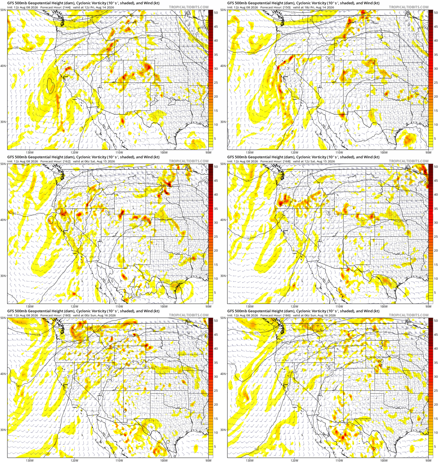
English: a lot of moisture and mid level tropical energy will be moving over a dry low level atmosphere. A classic signature for a lightning event especially for interior Northern California and eastern Oregon
What’s your guesstimate for when it might get to southern Oregon?
Just checked and north ops is showing a high risk for lightning on the 14th, which should be the approximate timing.
I know these events can be difficult to forecast, but isn’t issuing a high risk day, 6 days out a little premature?
This won’t be a popular statement but, NOPS has been wrong on every high risk day they have issued due to lightning this summer. I hope their streak continues.
I know South ops is supposed to cool next week with possible storms, but what does some of this mean for our long term? It should stay cooler in the long term? Or we should heat back up? Sorry if this is kinda a dumb question..
I am not sure I agree with the PDS has been wrong… lightning events can be very difficult to predict.
When you think about the mechanisms that have to come together for a true “dry lightning” event to unfold.. it is a complex process to sift through all the data while tight roping between issuing a warning and ignoring a trend.
California experiences dry lightning outbreaks based on three different overall mechanisms. The 4 corners high pressure center rotates moisture around it from Mexico or the Gulf and sends that north and west. That moisture can arrive in the form of high level clouds left over from large scale convection in that region or moisture in the lower levels( below 10000 feet) in the form of moisture bearing clouds, the second is a decaying tropical system which transits up or near the coast, the third is the passage of a cold front or weak trough.
In all of these cases there needs to be a few ingredients to come together.. available moisture at the right levels, a wave or “perturbation” or Vorticity… some type of passage of circulation to allow the moisture to build. That is representative of the state of the atmosphere( similar to why every time a fire builds a PC it will not “collapse”). The last item is CAPE or Convective Available Potential Energy.. or the secret sauce in the atmosphere. Is the atmosphere primed enough to allow the cloud formations to build? If the atmosphere is capped( not enough CAPE) then the clouds will build and then flatten out or just drift off with the general steering winds. Orographic lift plays a role as do convergence zones..
So all of that has to come together for a forecast to resolve.
As far as making a forecast 6 days out. There have been trends on the models( multi-model support) depicting remnant moisture making its presence felt across the Central and Northern portions of the state. Each run has been different but consistent. This is also a within expected climatology for this time of the year.. so not out of the ordinary.
I have worked with the IMET’s from PDS on several occasions.. they are really good and singularly focused on fire weather rather than their counterparts at the NSW who have to balance their time looking at weather impacts on recreation, commerce and the general public.
We will have to watch what unfolds this week.. but would not be surprised to see an outbreak over at least two different PSA’s by weeks end.
I agree that it is a very risky move. But due to the climatology and previous experience with the setup on top of fuels that are critically dry I can see why they issued the high risk day. I think most of the risk will again be centered in Oregon. I have more thoughts regarding lightning coming up, but I want to make sure we cross certain temporal markers first…..
We should heat up significantly around the 20th towards the end of the month. The downstream effects of dolphin have slowed because the storm has moved much slower than originally forecasted so those downstream effects should be experienced more towards the end of the month.
And expanding on what he said… true dry lightning busts are impossible to forecast. The events we associate with being major true fire storms events like 2020 rely on extreme ridging and a wrinkle in the ridge that allows for the storms to ingest dry air from the stratosphere, and it’s too small of a set up for models to comprehend and predict if there’s going to be enough instability to produce widespread lightning. This is called “upper tropospheric folding” and if I’m remembering correctly they only forecasted the extreme event right at the tail end as it started in 2020. So it’s a safe VS sorry situation.
Thank you for continuing to take my stupid questions..
Active Lightning ground strikes approximately a ten mile radius around Florence Lake on the SNF. Way up there 7000’. 7 strikes in last hour…13:00-14:00hrs.
Mt. Tom L.O. is watching it. No rain.
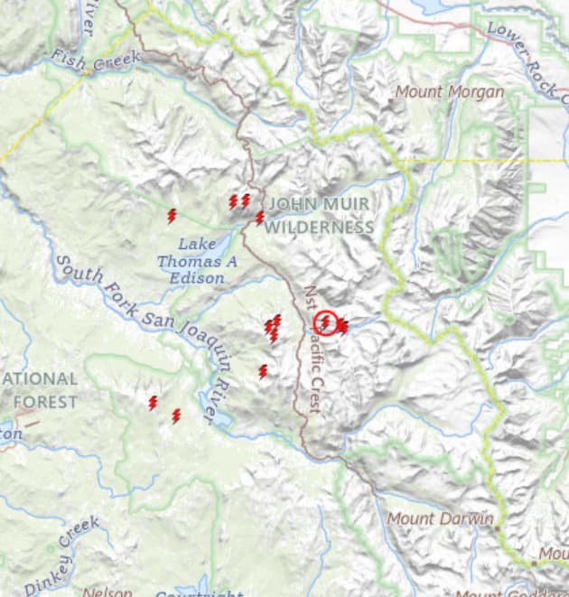
Lightning fires starting to pop up. Bear Valley 1 camera has three in one shot. I believe that’s the STF, right?