Good view of the downslope smoke push, out into the city from Dunlap Acres cam timelapse: ALERTCalifornia - Dunlap Acres 1
He said “helo”…not ground
Sep 7 at 4:53 PM
Per the San Bernardino County Sheriff Office an Evacuation Order is now in effect for all of the communities of Running Springs and Arrow Bear Lake.
Chuck Henry
(6) Type 1 air tankers and (3) VLATS requested due to imminent life threat.
Anyone have a scanner? Broadcastify is coming up with nothing besides CHP.
That’s what I heard it’s a real ingress egress issue for sure. And looking at pocket cards and weather forecast they got a real burner on their hands.
In 2003 we all got send up Old Waterman Cyn Rd to Crestline then Rim of the World for staging and assignments. It’s a tough windy road to traverse.
I remember that 03 was a tough season lots of runs. Every time we thought we had it she’d take off on us again.
ABC 7 has Air 7 up now
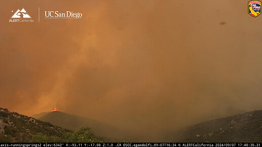
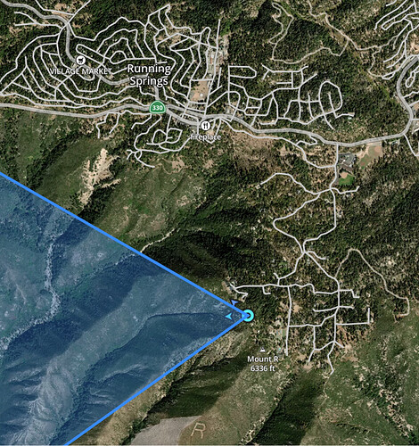
Flames visible beneath the Running Springs 2 camera, which abuts a neighborhood SE of the main part of the community.
According to PulsePoint, VNC is lining-up an Alpha team and a Charlie team.
(6) Type 1 air tankers and (3) VLATS requested due to imminent life threat.
FJ or Anyone hear if they got fills on any of these?
Six-camera multiview, updated for best current perspectives w/ smoke
I feel like when these cameras switch to IR this evening, we’re going to see the fire is extended further than what it appears now.
The live stream from ABC7 is absolutely useless. Shows roads and smoke
Bumper to bumper traffic from Running Springs to Crest Forest with fire coming up into Running Springs
Not alot of good safety zones in the area of Running Springs, the school and the caltrans yards are really all they have. Arrowbear is alot of windy roads, Green Valley is the same.
Region 1 OES now trying to fill multiple strike teams…not seen that before


