
http://www.alertwildfire.org/shastamodoc/index.html?camera=Axis-IndianRidge&v=fd40729
3 Likes
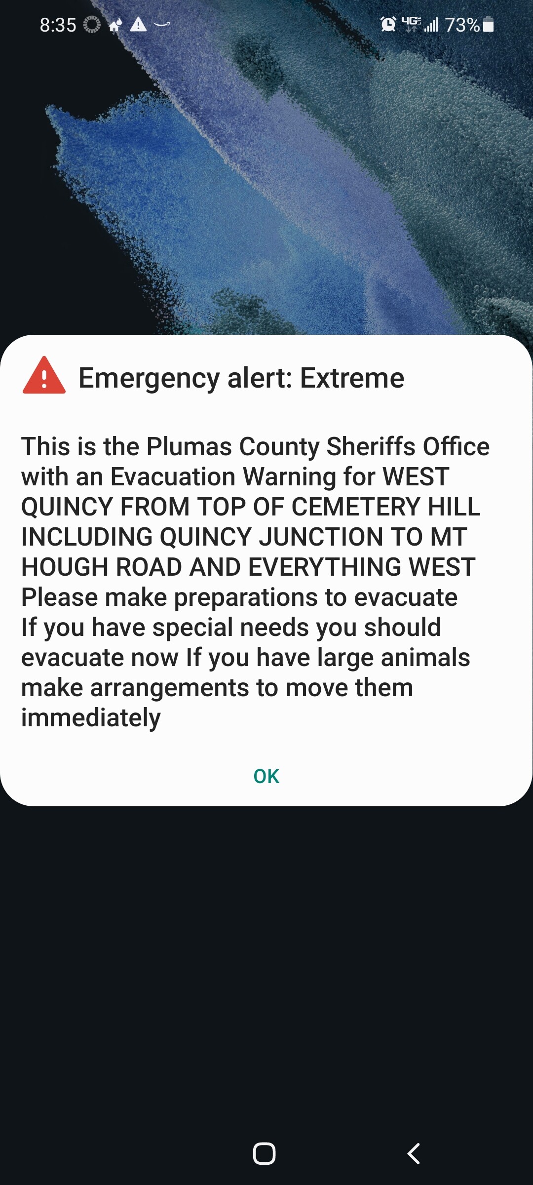
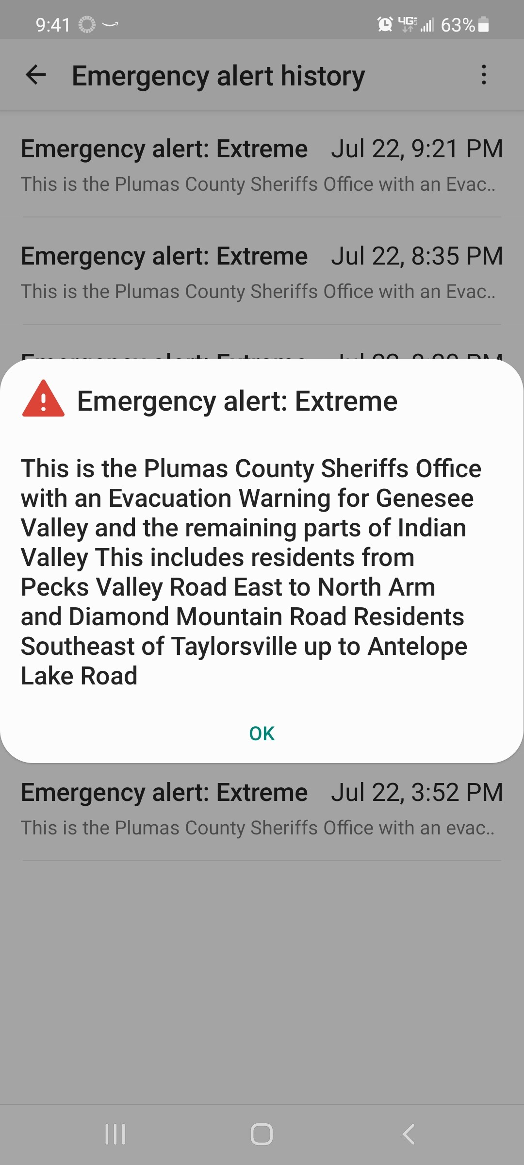
Fire at Butterfly Valley Rd/Keddie started about 5pm, and is really taking off. Pre CHP CAD, Highway 70 is closed from Greenville Wye to Quincy. Highway 89 closed from Indian Valley south - if evacuating Indian Valley, head up Hwy 89 to Almanor.
http://www.alertwildfire.org/shastamodoc/index.html?camera=Axis-EastQuincy&v=fd40729
3 Likes
Looks like the new start already spotting down wind to the next ridge.
3 Likes
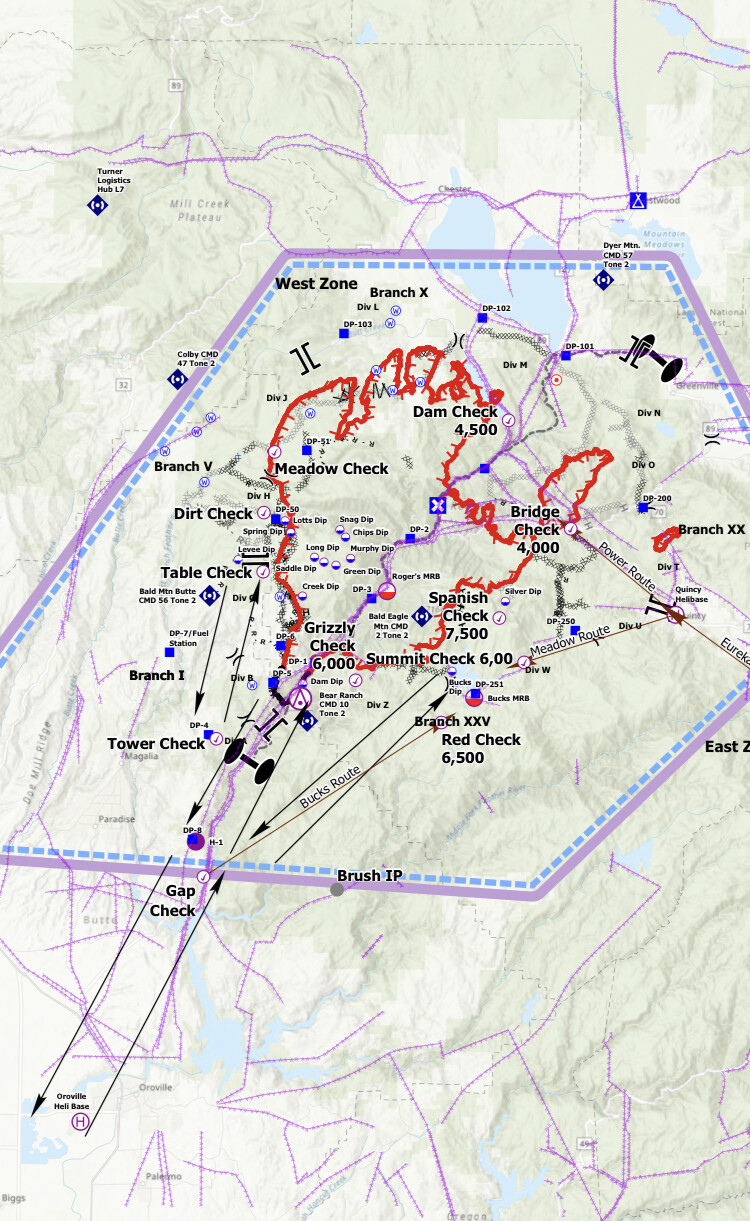
Reminder, official evac maps: ArcGIS Web Application
Plumas Zone 17 Quincy West is under an evac WARNING only, NOT an order.
6 Likes
103,910 acres and 17% contained
5 Likes
113,006 acres 18%contained per tonight’s briefing
6 Likes
Can someone explain the dots on that map?
What dots? Dotted lines?
Also this map was released this morning. Fire is definitely bigger
The map comment was removed? There were dots along all the edges instead on coordinates and even behind all of the writing.
2230 Thur: Courtney Air up on the mapping mission, finished and now giving some Situational Awareness to Night Ops. Has a spot 2.5mi north of the main fire in Div R. 500x500 spot near Tamarack Cutoff Road and Humboldt Rd. Sort of near DP-103. A couple more spots on Div R, 300x300, 1.25mi north of fire, on other side of Butt Creek down in the bottom.
2315: Firing operation right now in Div R northeast of Butt Valley Reservoir. From Prattville Road just before the surge chamber, SE along the base of the hills, following the 4800ft contour in the flats. This is right below the Butt Lake camera which currently has a PGE operator driving it and steering around looking at ground around the camera. 15min timelapse now has some good bits of the firing op.
11 Likes
Almanor West area Firing heat is now showing
https://caltopo.com/map.html#ll=40.18111,-121.15294&z=13&b=t&o=f16a%2Cr&n=1,0.25&a=mba%2Cfire%2Cmodis_mp
There is a scan of heat north of Round valley Reservoir/ Long Valley Road 204?? You’ll need to pan right or zoom out.
2 Likes
DATA PACKAGE is posted at maps.takserver.us
*** the one labeled OPS is only the East and West Ops Maps****
2 Likes