Creating a place for the general discussion about The Fly
I can’t seem to find any scanner that covers PNF ? Anyone know of one online
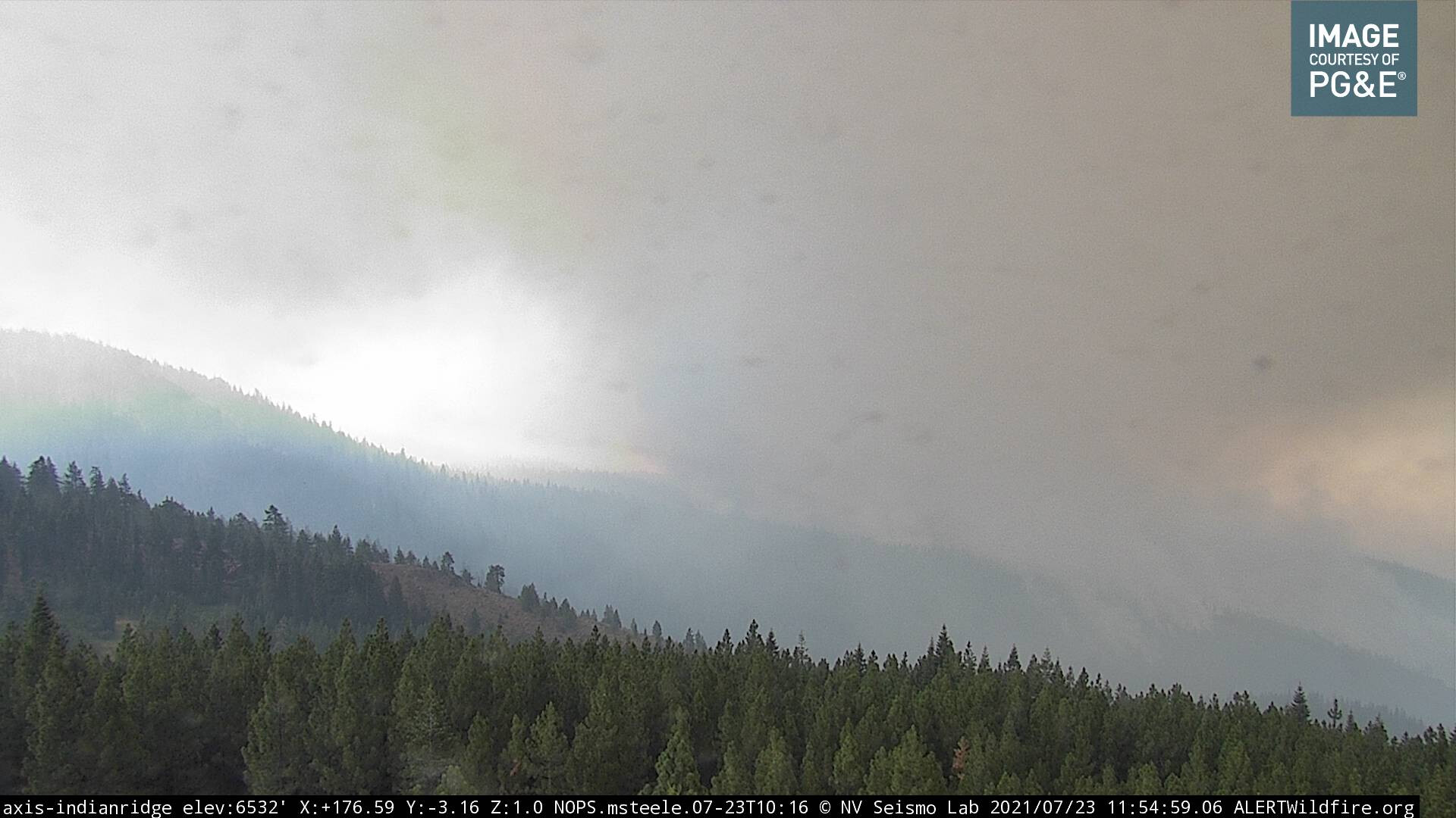
Appears that the Fly fire is approaching the Indian Ridge cam. GOES-17 is back up and picking up pretty good heat from this area as well.
3 Likes
I think the Fly Fire is a cautionary tale for us all. Went to 1600+ acres, at night, in the timber despite have a lot of air and ground resources immediately available it still could not be caught. Similar the the Salt Fire where air & ground resource from the near by Lava Fire were there much quicker then a typical response and it too blew out.
11 Likes
THREE VLATs were there (911, 912, & 914) and it still went to 1600+, etc… so yep, I agree with you.
2 Likes
She was going to make that initial run and nothing was going to Deny Her. It was pretty impressive.
3 Likes
A friend (in East Quincy)just texted me that all of Quincy just received an evac warning.
7 Likes
2 Likes
re: Fly IA thread…
Almost looked like a collapse or blow out from the Dixie fire.
Then the Fly fire gets stoked up when out-flow cloud hits it.
Actually, it kinda looks like both headers on that front got stoked by the outflow.
Have to zoom in. starts around 19:50 UTC
The way that wall of smoke rolled across the valley didn’t really look like Fly fire had any effect on it.
2 Likes
Not going to disagree with your assessment of what happened. The two columns seems to align up on the upper end of the column which would indicate a pull from the Fly but the rapid ground level intrusion would appear to be off the Dixie as the column collapsed pushing massive air into Quincy and subsequently the Fly. Either way it happened, there is some very radical ground level fire behavior going on.
3 Likes
Last 15 minutes on the RadioHill1 cam look apocalyptic. Makes me wonder if Dixie blew out into the Spanish Creek drainage when the outflow event occurred.
3 Likes
Fuels are very volatile earlier this year throughout the west. IA stops are still being done, but it will take combined resources to engage aggressively.
“ LCES” cannot be comprised.
6 Likes
Not seeing any air support again today on flightradar24. Any idea if that might change? Shame they don’t have access to the 747’s this year…
It will change when the visibility improves enough for them to do some effective drops and be safe enough to fly, not before
10 Likes
The smoke has lifted a little this morning but not much/ Winds in Paradise are light and out of the SE.
This is about the time of day the inversion has lifted and the winds pick up… So far it doesn’t look too good for flying low. only visibility I can find close is for Susanville and it is at 3 miles with a cieling of 3000 ft. What you see in the camera’s at dyer
http://www.alertwildfire.org/shastamodoc/index.html?camera=Axis-DyerMtn2
or Indian Ridge
http://www.alertwildfire.org/shastamodoc/index.html?camera=Axis-IndianRidge
do not appear on camera to be even close to those numbers.
Sort of a double edged sword. clean air to fly in, clean air for the fire to feed on
5 Likes
See this thread
It is not the end all be all, and would not be good for the confines of the Feather River Canyon
Air Resources are limited by visibility, which this area is known for having issues with. Last year during the North Complex there were many days of margin or no visibility for flying.
8 Likes
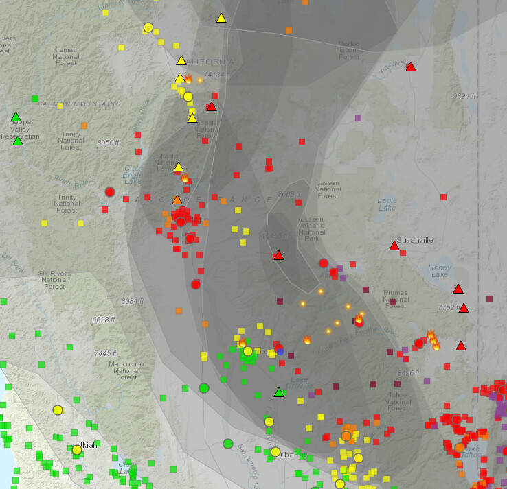
I was looking for some sort of visibility map and tripped over this. Not sure it translates well to this page . so check it out yourself if you are of a mind . kind of interesting to look over
Sort of gives you an idea why there is nothing in the air yet today
this is kind of interesting graphics as well
7 Likes
Agree
Been on a few fires with that platform. Not impressed at all with performance or coverage
2 Likes
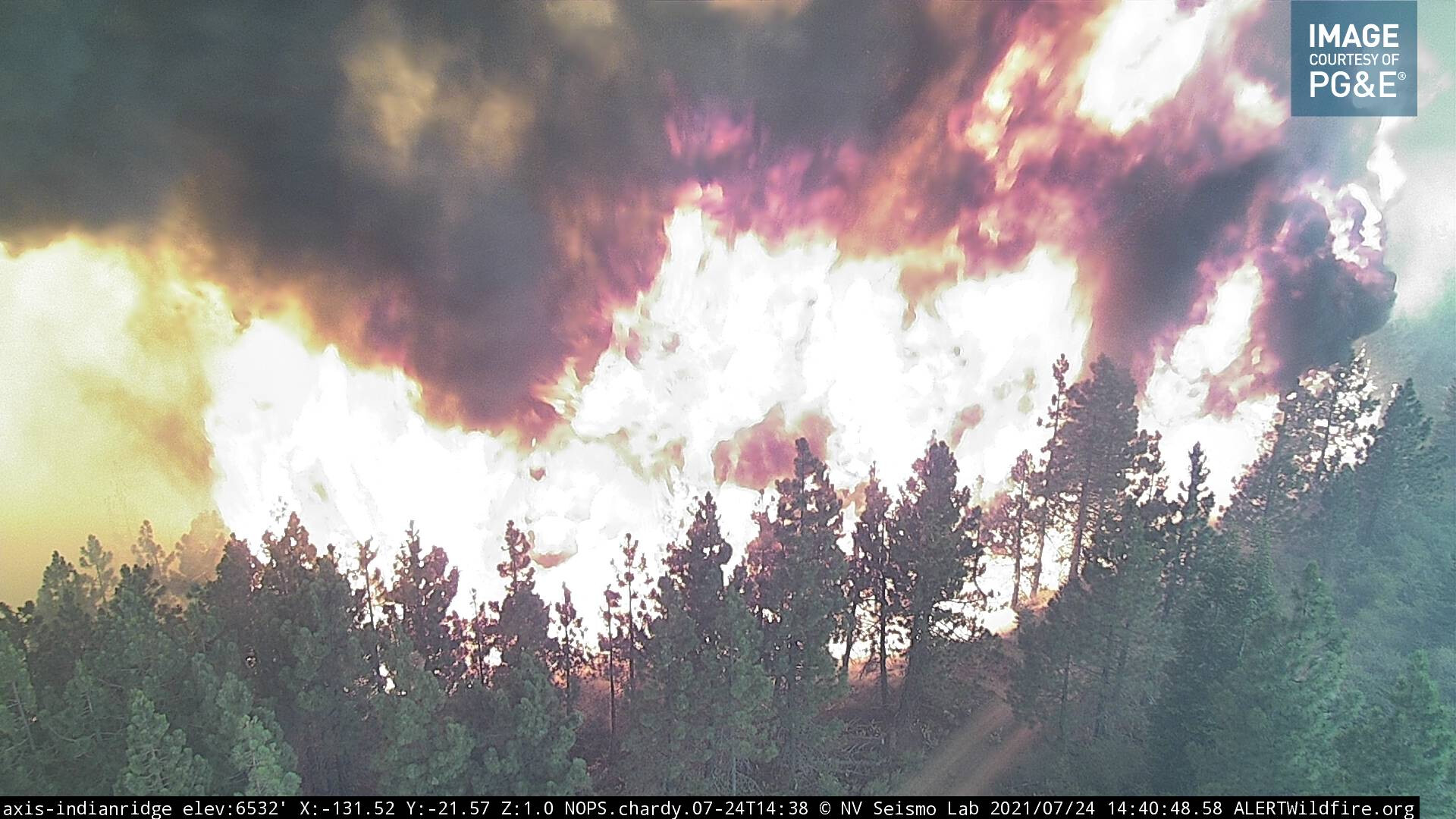
The Fly fire over ran the Indian Ridge Tower/Camera between 2 and 3 O’clock.
Run back the camera loop . You will start to see the dark smoke at 14:10 . Then the fire rages thru.
It is amazing the camera survived. In a matter of minutes it turned that ridge into sticks
http://www.alertwildfire.org/shastamodoc/index.html?camera=Axis-IndianRidge
16 Likes