Got your email, Thank you very much.
The intensity of this fire will be stand replacement in most of the area in the canyon where it ran so hard and hot. Replacement vegetation will need to be monitored as exotics and invasive species may take the opportunity to dominate.
Incident maps from NIFC FTP site: https://ftp.nifc.gov/public/incident_specific_data/calif_s/!2020_Incidents/CA-SNF-001391_Creek/GIS/Products/20200907/
DIV-B -Air show trying to help keep it out of North Fork, hitting it hard NE of town.
Working the N-S ridge just west of Whiskey Creek.
DIV-U -Fire coming up the draw toward Shaver Lake Heights pretty strong.
Requesting everyone in DIV U back up to Shaver Lake town.
HARD closure of 168 at “top of 4 lanes at Auberry road”
INCLUDING fire personnel, nobody goes up 168!
@10:45 thru 10:55
168 is going to get hit hard and the size of the runs this thing has been making I do not seeing them keeping it out of north fork or even holding the 168.
Continuing the discussion from CA-SNF-Creek:
I own three cabins in the Huckleberry tract near Cedar Crest. They are very special to me and my family. A recent post said the fire was headed east toward Cedar Crest. Please keep us posted. Thank you.
How close is the fire from Woodbridge rd in the community of ockenden.
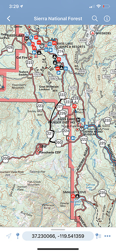
Anyone have an interactive map of the evacuations of North Fork? I know the intel but it’s really hard to pin point between all the roads. I am uploading a map which has some of the roads mentioned. Please send a link if you have an up to date interactive evac map.
Nathan Magsig posted a video from Auberry Rd at Musick Rd, showing Jose Basin in between Alder Springs and Meadow Lakes to be fully engulfed. This would include Acorn.
And we would find this video where?
Maybe this one? I tried To link it.
Thanks. FWIW it shows that I can’t see it due to MIME and unsupported format issues.
Found it on his facebork page.
Sorry, I couldn’t get the link to paste. Darned Mac!
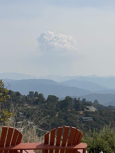
Dolan Fire I believe?
Or maybe 10 am toward creek?
MAYBE a cap visible across the Central Valley, but that whole lower column is visible. And shadows look like 3:30 pm of facing south.
Conducting a very large firing operation on the Dolan Fire today… would be the reason for the large column. Hope the lines hold otherwise we will have another Soberanes Fire in our hands.
It’s definitely a large operation from what’s visible


