Well it is 105 with an 8% humidity right now in Red Bluff… that might help things move out a bit.
Redding is 104 with 9%
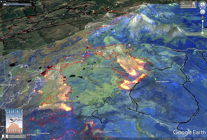
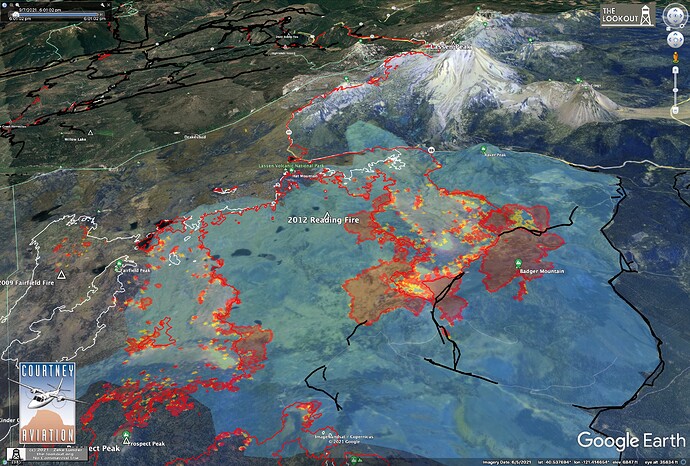
Dixie Fire in 2012 Reading Fire area jumped control lines today. About 5,000 acres burned there past 2 days. Satellite imagery 9/6 at noon captured a firing operation ahead of main fire’s spread. Heat maps from tonight show the escape. Winds are forecast. https://www.wrh.noaa.gov/eccda/eccda_dh.php?ecczone=ECC004
KML files filtered from 20210908 data package found here:
https://ftp.wildfire.gov/public/incident_specific_data/calif_n/!CALFIRE/!2021_Incidents/CA-BTU-009205_Dixie/GIS/IncidentData/20210908/
For import into CalTopo, Google Earth, etc. Can’t vouch for how accurate they keep the data vs what’s really on the ground.
Contained Line. There are 77 entries vs 75 yesterday.
Completed Dozer Line. There are 3750 entries vs 3705 yesterday:
Completed All Type Of Line. There are 4912 entries vs 4854 yesterday:
Planned All Type Of Line. There are 151 entries vs 148 yesterday:
Based on IAPS look like they have a lot of resources in Portola. Is this where the spread is going towards or is it go more east again? Have jot found a great map.
Fire weather watch for thunderstorms and dry lightning today.
KML files filtered from 20210909 data package found here:
https://ftp.wildfire.gov/public/incident_specific_data/calif_n/!CALFIRE/!2021_Incidents/CA-BTU-009205_Dixie/GIS/IncidentData/20210909/
For import into CalTopo, Google Earth, etc. Can’t vouch for how accurate they keep the data vs what’s really on the ground.
Contained Line. There are 93 entries vs 77 yesterday.
Completed Dozer Line. There are 3764 entries vs 3750 yesterday:
Completed All Type Of Line. There are 4937 entries vs 4912 yesterday:
Planned All Type Of Line. There are 150entries vs 151 yesterday:
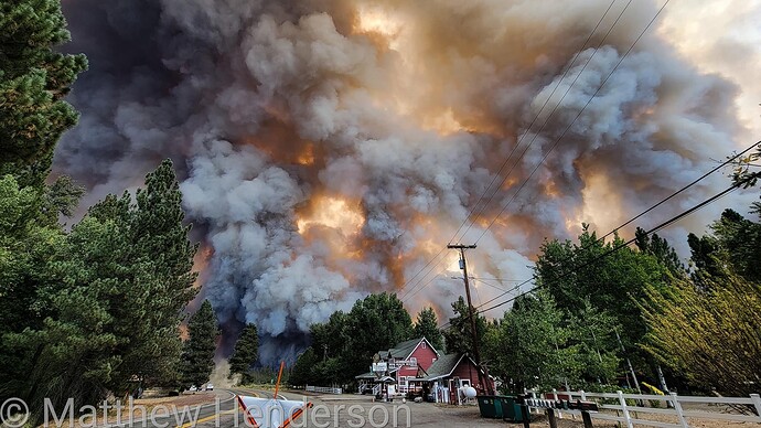
Ground troops hard at work doing structure protection in Old Station. Fire made a huge push across 44 again. Running out of the Potato Butte area and along the Hat Creek Rim
KML files filtered from 20210910 data package found here:
https://ftp.wildfire.gov/public/incident_specific_data/calif_n/!CALFIRE/!2021_Incidents/CA-BTU-009205_Dixie/GIS/IncidentData/20210910/
For import into CalTopo, Google Earth, etc. Can’t vouch for how accurate they keep the data vs what’s really on the ground.
Contained Line. There are 93 entries vs 93 yesterday.
Completed Dozer Line. There are 3804 entries vs 3764 yesterday:
Completed All Type Of Line. There are 4976 entries vs 4937 yesterday:
Planned All Type Of Line. There are 155 entries vs 150 yesterday:
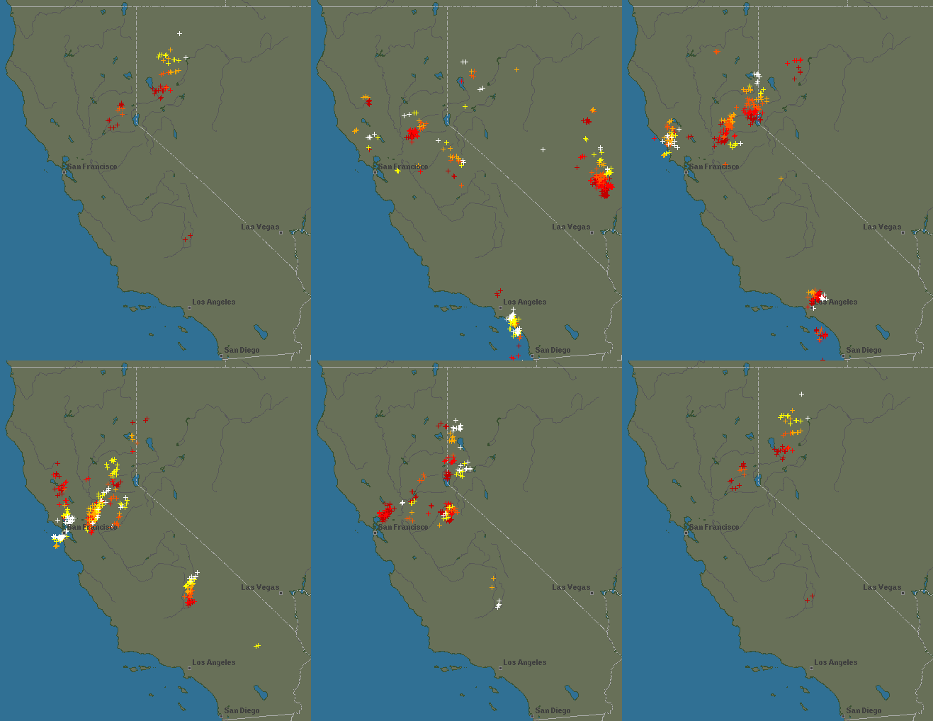
Adding a lightning history loop done at 9:25 am today:
12 hour lighting history loop from Lightning & Thunderstorms - Map History
AA with 3 maffs and 3 vlats along with a couple helicopters working north of 44 since 3pm. Good day to make alot of progress securing that section.
Mapping taking place too.
KML files filtered from 20210911 data package found here:
https://ftp.wildfire.gov/public/incident_specific_data/calif_n/!CALFIRE/!2021_Incidents/CA-BTU-009205_Dixie/GIS/IncidentData/20210911/
For import into CalTopo, Google Earth, etc. Can’t vouch for how accurate they keep the data vs what’s really on the ground.
Contained Line. There are 93 entries vs 93 yesterday.
Completed Dozer Line. There are 3813 entries vs 3804 yesterday:
Completed All Type Of Line. There are 4990 entries vs 4976 yesterday:
Planned All Type Of Line. There are 149 entries vs 155 yesterday:
KML files filtered from 20210912 data package found here:
https://ftp.wildfire.gov/public/incident_specific_data/calif_n/!CALFIRE/!2021_Incidents/CA-BTU-009205_Dixie/GIS/IncidentData/20210912/
For import into CalTopo, Google Earth, etc. Can’t vouch for how accurate they keep the data vs what’s really on the ground.
Contained Line. There are 95 entries vs 93 yesterday.
Completed Dozer Line. There are 3859 entries vs 3813 yesterday:
Completed All Type Of Line. There are 5060 entries vs 4990 yesterday:
Planned All Type Of Line. There are 150 entries vs 149 yesterday:
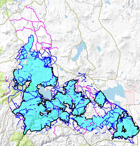
Throw all the lines on a map, what do you get?
Black = Contained Line.
Blue = Completed All Type Of Line.
Purple = Planned All Type Of Line.
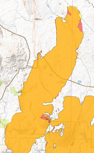
Perimeter changes yesterday vs today. The only changes I see are north LNP & Old Station area. They removed some perimeter that was in yesterday’s data.
Yellow = yesterday.
Red = today.
Orange = both days overlap.
Bit of a flareup on the meadow past the end of First in Chester, we’ll see if it amounts to anything:
No Dixie data package for today uploaded yet on the FTP site. I’m headed out for vacation for a few days so if they release one later today I won’t be around to create KML files for it or the next few days. Take care and I hope to see these fires behaved while I was gone.
960,470 Acres and 86% contained.
963,276 Acres and 90% contained.
No change in acreage with 94% containment.

